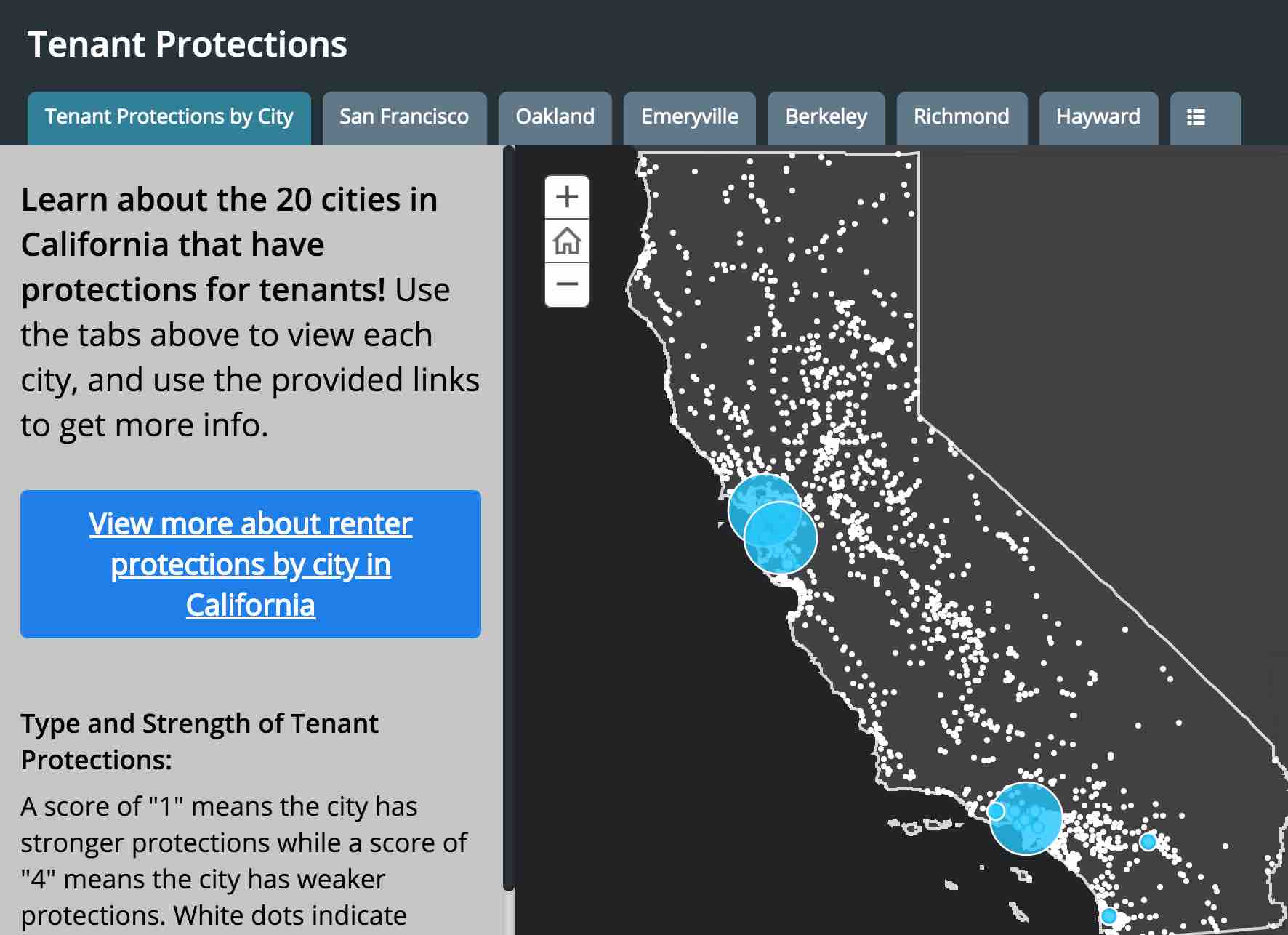
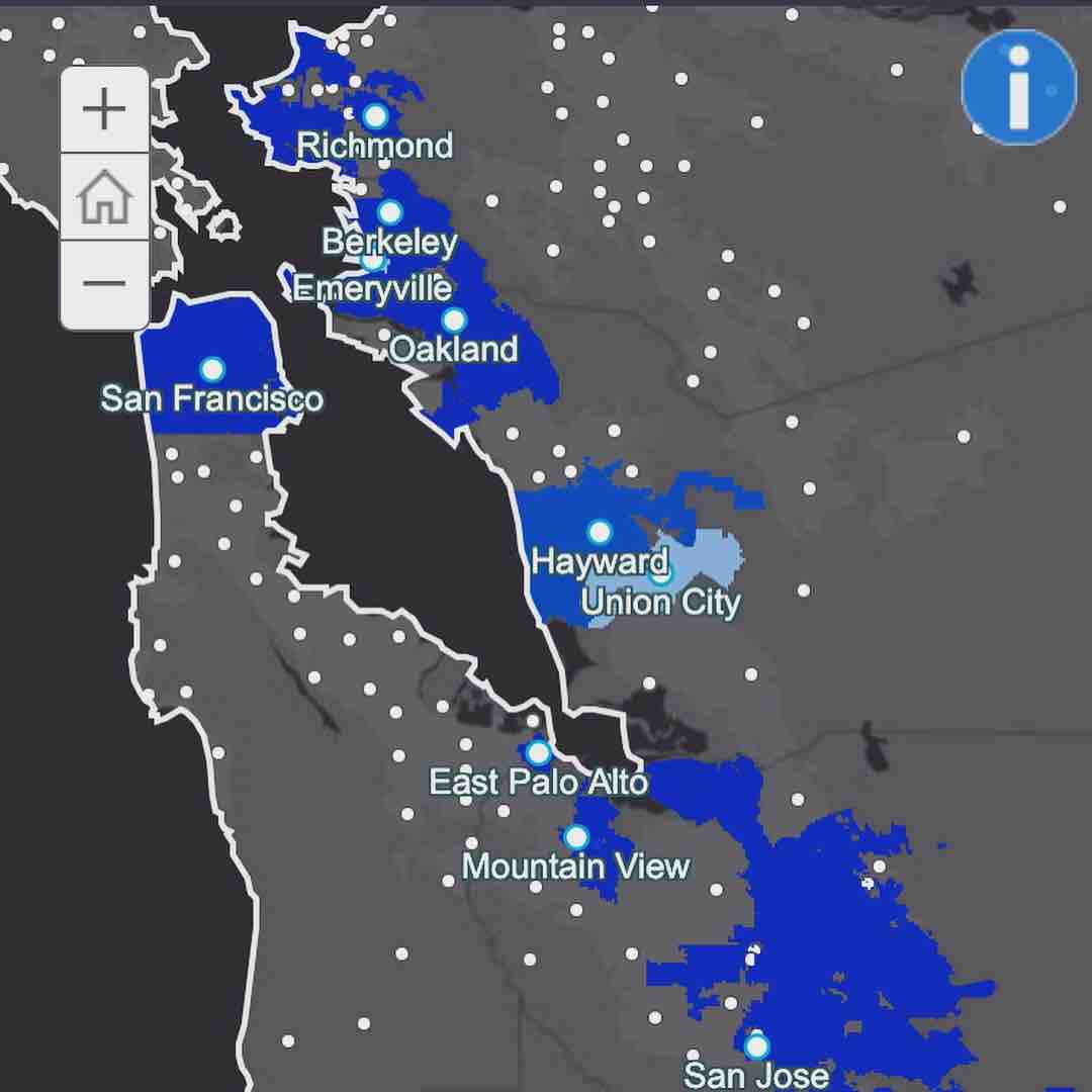
I collaborated with The Anti-Eviction Mapping Project and Tenants Together on an interactive mapping + narrative project about rent control and just cause protections in California. The project featured three maps:
Tenant Protections by City: This map looks at the presence and strength of tenant protection policies city-by-city, as well as giving a look at the presence [or lack there of] these policies across California. Tabs allow viewers to get an in depth look at each city's policies, and access to more information.
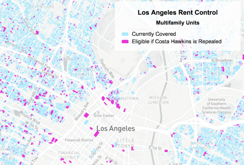
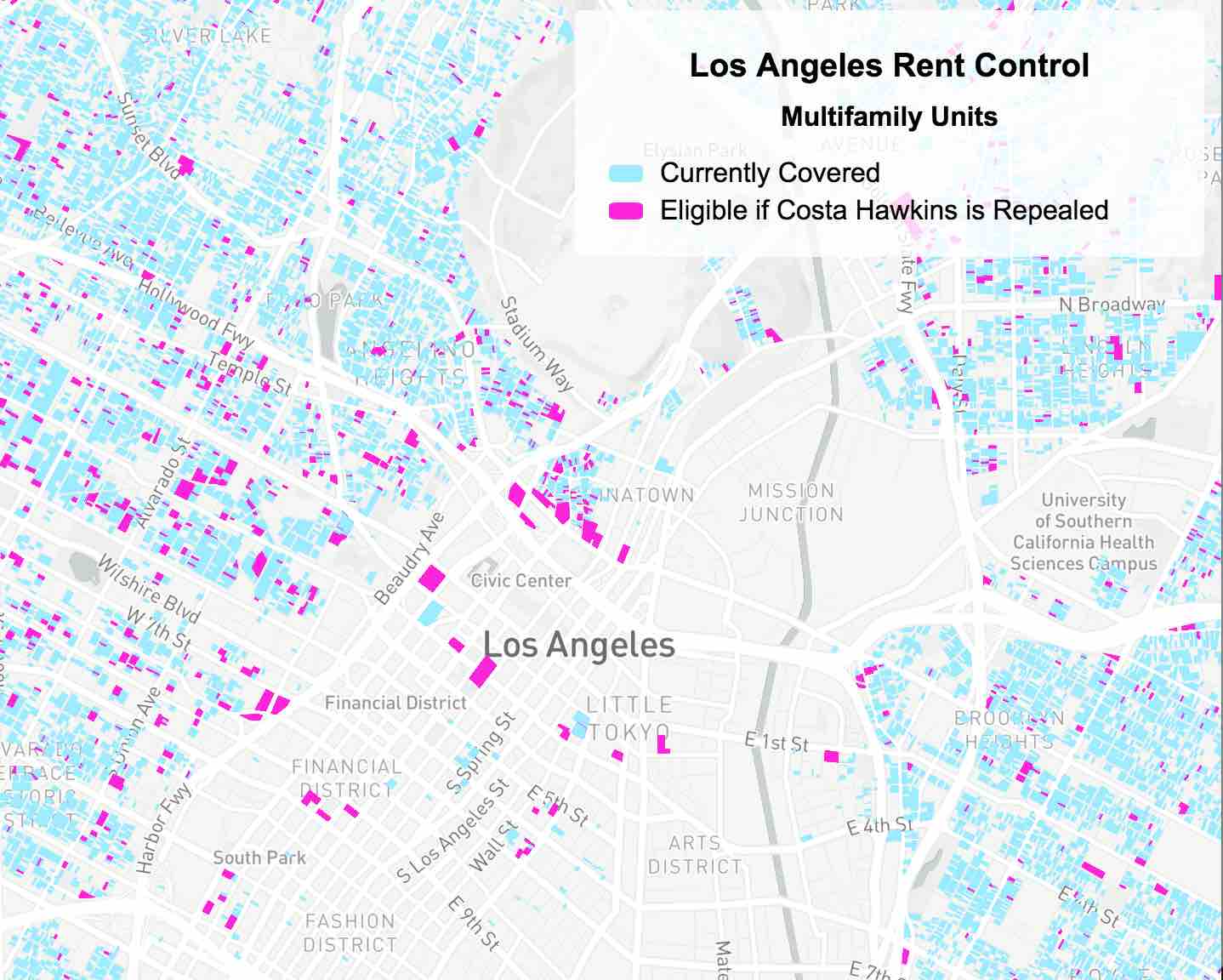
Los Angeles Rent Control Coverage by Unit: This map displays multifamily units that are currently covered under Los Angeles rent control policy in contrast to the units that would be eligible for coverage if the Costa Hawkins Act is repealed.
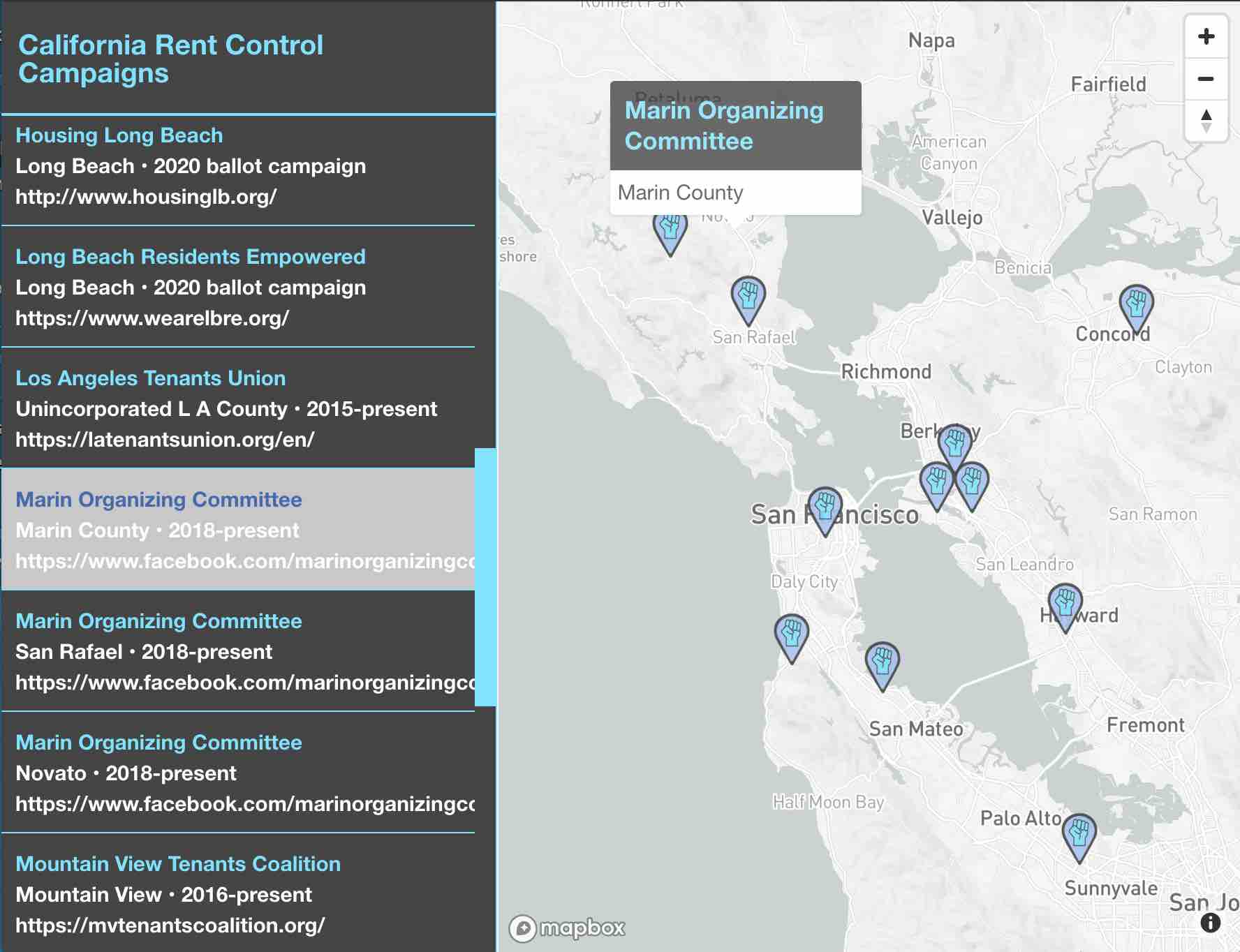
California Rent Control Campaigns: This map visualizes campaigns for rent control across the state.
Clients: Tenants Together + Anti-Eviction Mapping Project
Date: October 2018
Services: Data Management, Cartography, Web Development
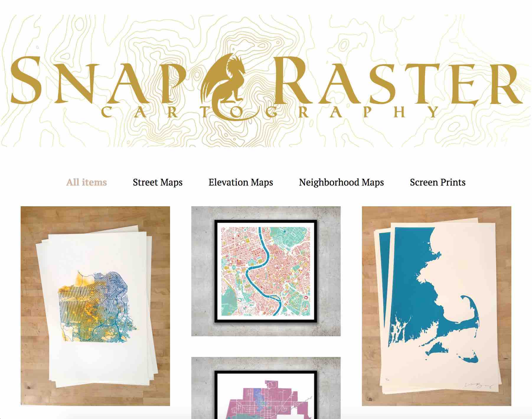
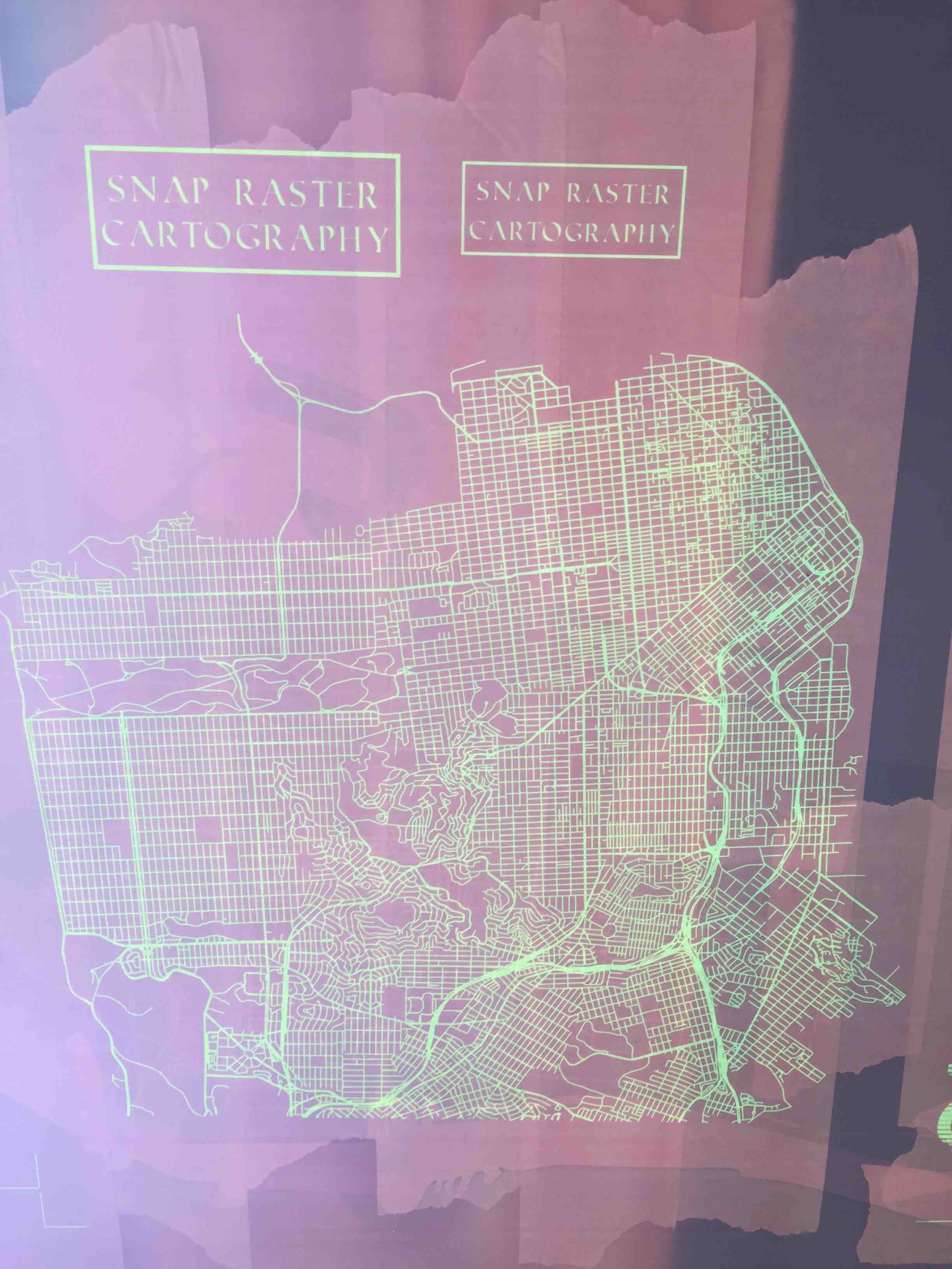
Snap Raster Cartography
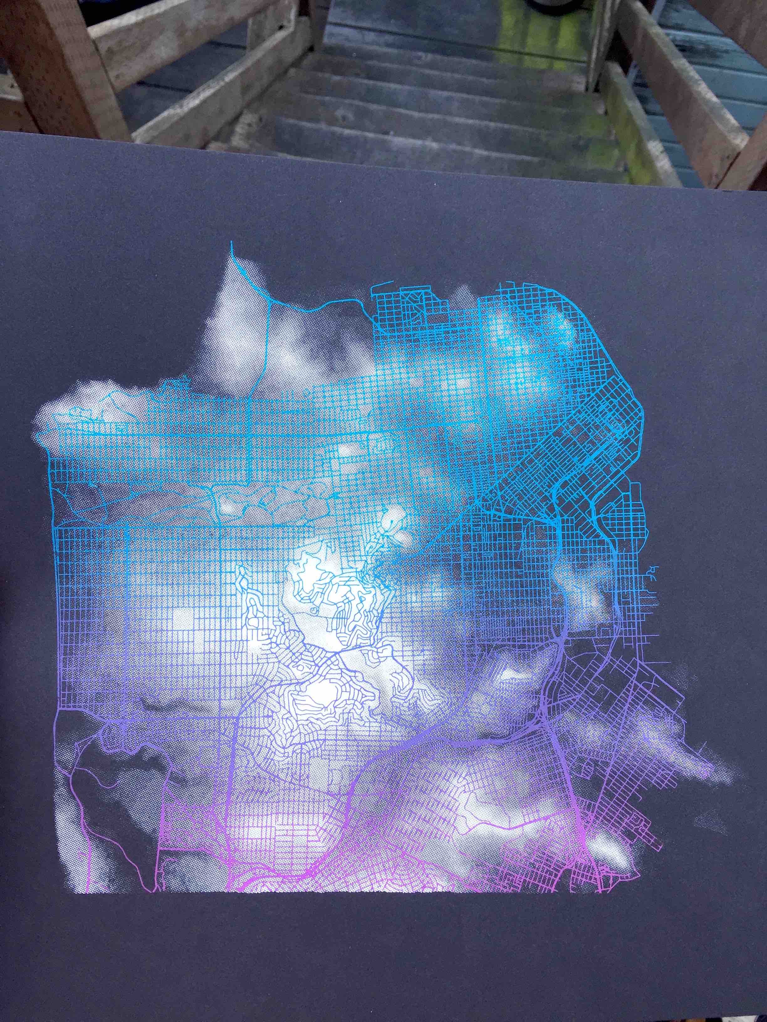
I created Snap Raster Cartography to produce and share maps focused on people's spatial knowledge of a place. Viewers are challenged to use their familiarity with geographic features to orient themselves and navigate the map.
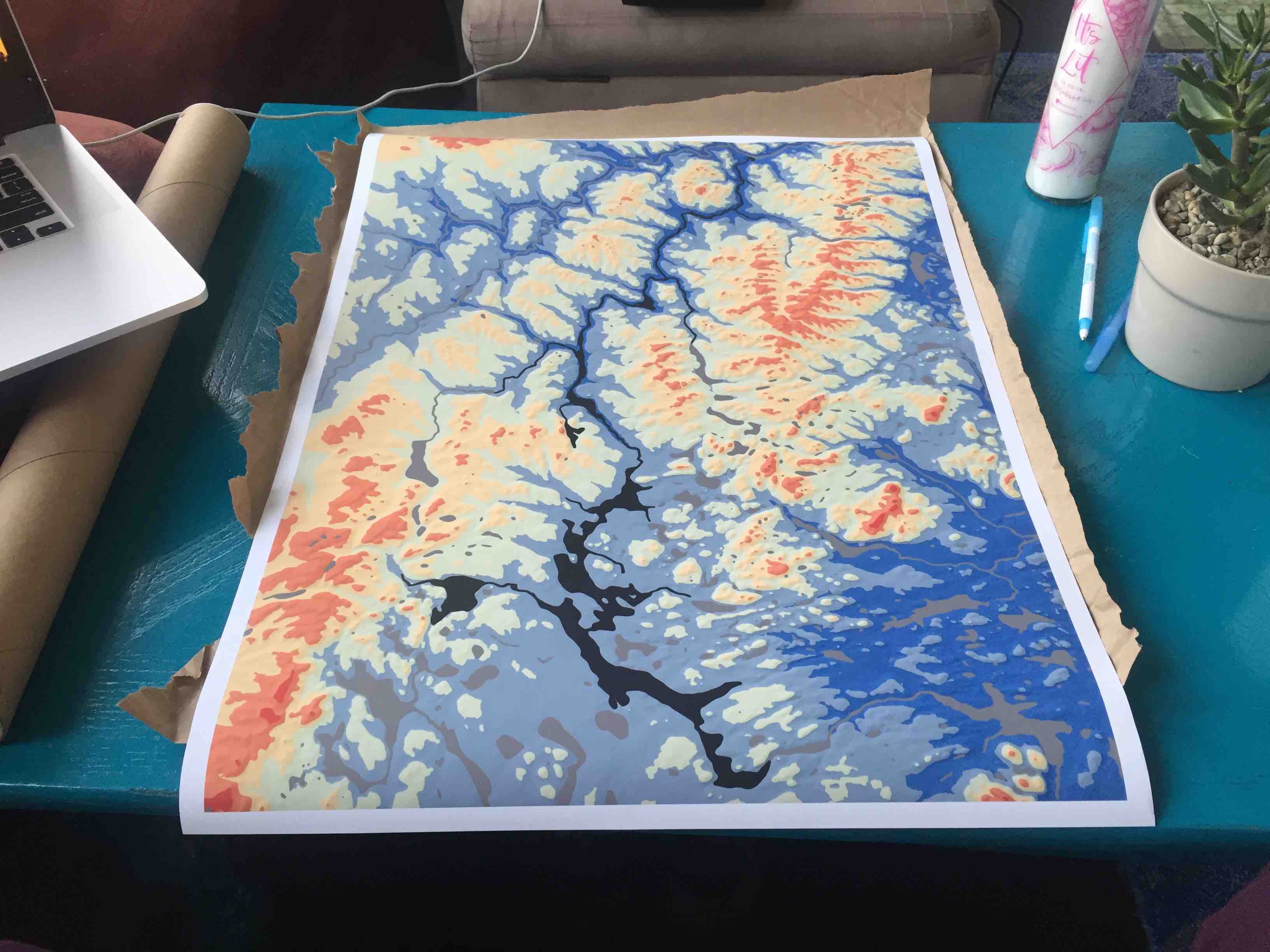
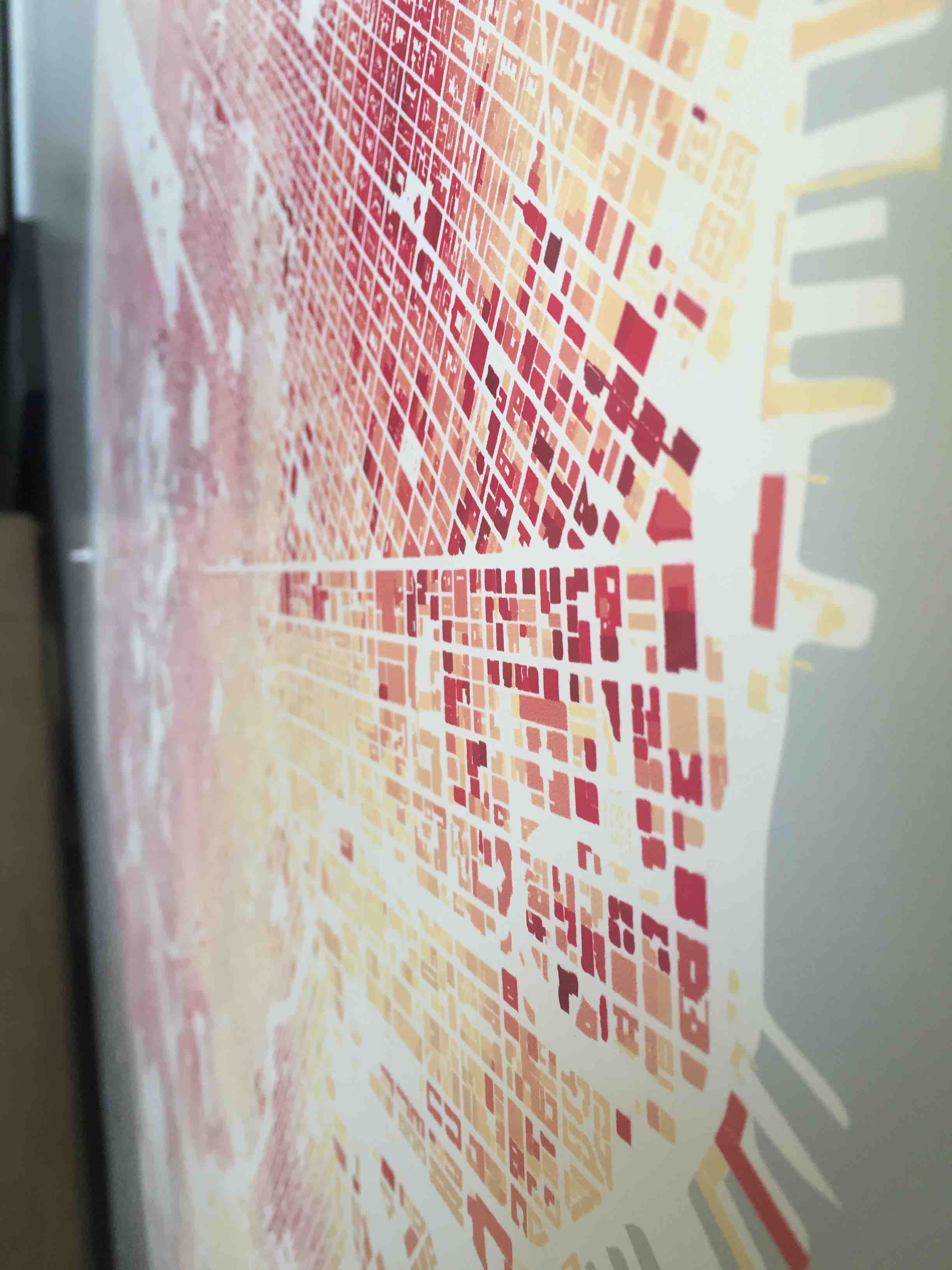
The Process: I start every map with spatial data. I research online for the appropriate data, download it, and then access it in a mapping program (try to imagine how Google Maps is created, but way simpler). In this mapping program I can do all kinds of extractions and spatial analysis depending on what I want to create. For example, the San Francisco Hills Map is created by extracting the highest elevation point of each building and assigning that value to the building. So that when color is added, viewers can identify skyscrapers in downtown as well as hills and valleys around the city.
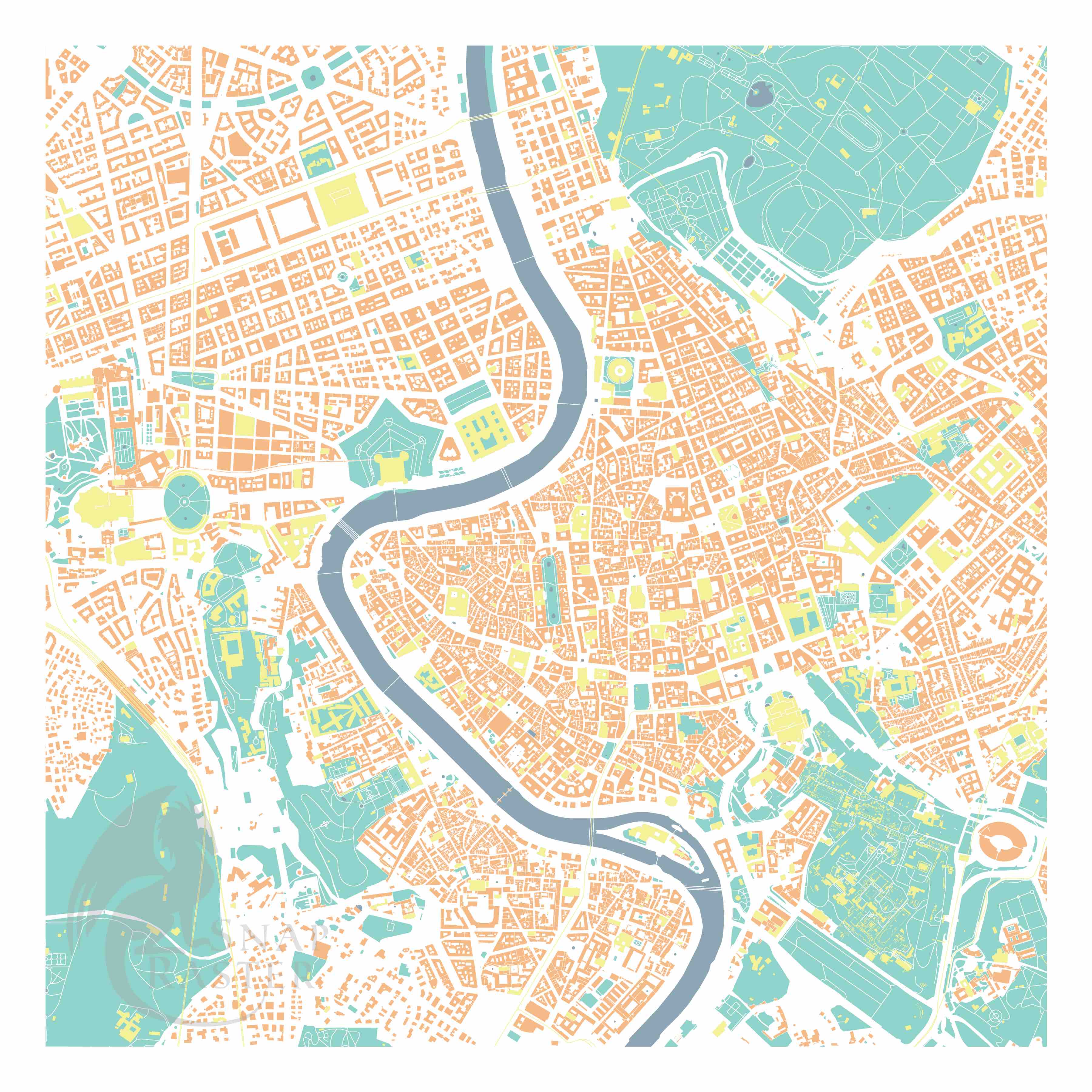
To get really technical, some of the data I work with is raster data (the water depth of the SF Bathymetry Map, the elevation of the Allagash River Map), which can be smoothed, or recalculated, or interpolated in a variety of ways. And most of the data I use is vector data, which can be streets, or buildings, or bodies of water. In the Rome Map I used the building data's underlying information to identify important points of interest and pull them out. The resulting map stacks many layers of spatial data to provide a detailed, yet textless landscape for familiar viewers to interpret.
Next, I export the map into an imagery editing program to smooth the features and make final color decisions. For the majority of my maps, I then send them to print at my local print shop ( Replica Digital Ink) that uses the highest quality ink and paper. But for some, I print them myself...
Screen Printing Process: There's certain effects that can only be captured by manually printing with ink poured out and pulled over a screen. For a few of my maps, after I complete the above process, I then send the digital files to my local screen printing shop ( Anthem Printing) where they burn the images on to screens. Then I use these screens to transfer ink onto paper to create my maps (check out my photo gallery to see more for pictures of the process).
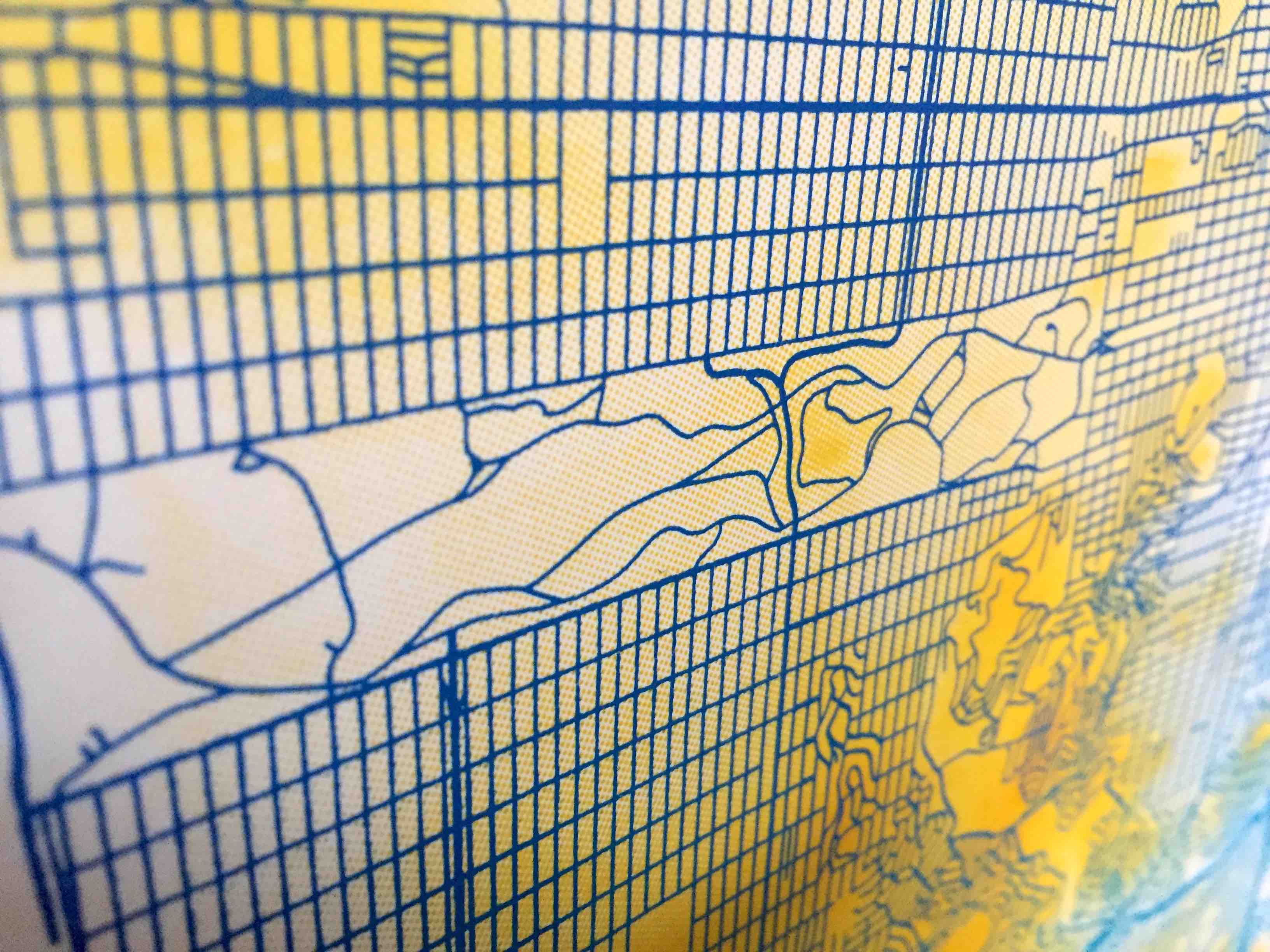
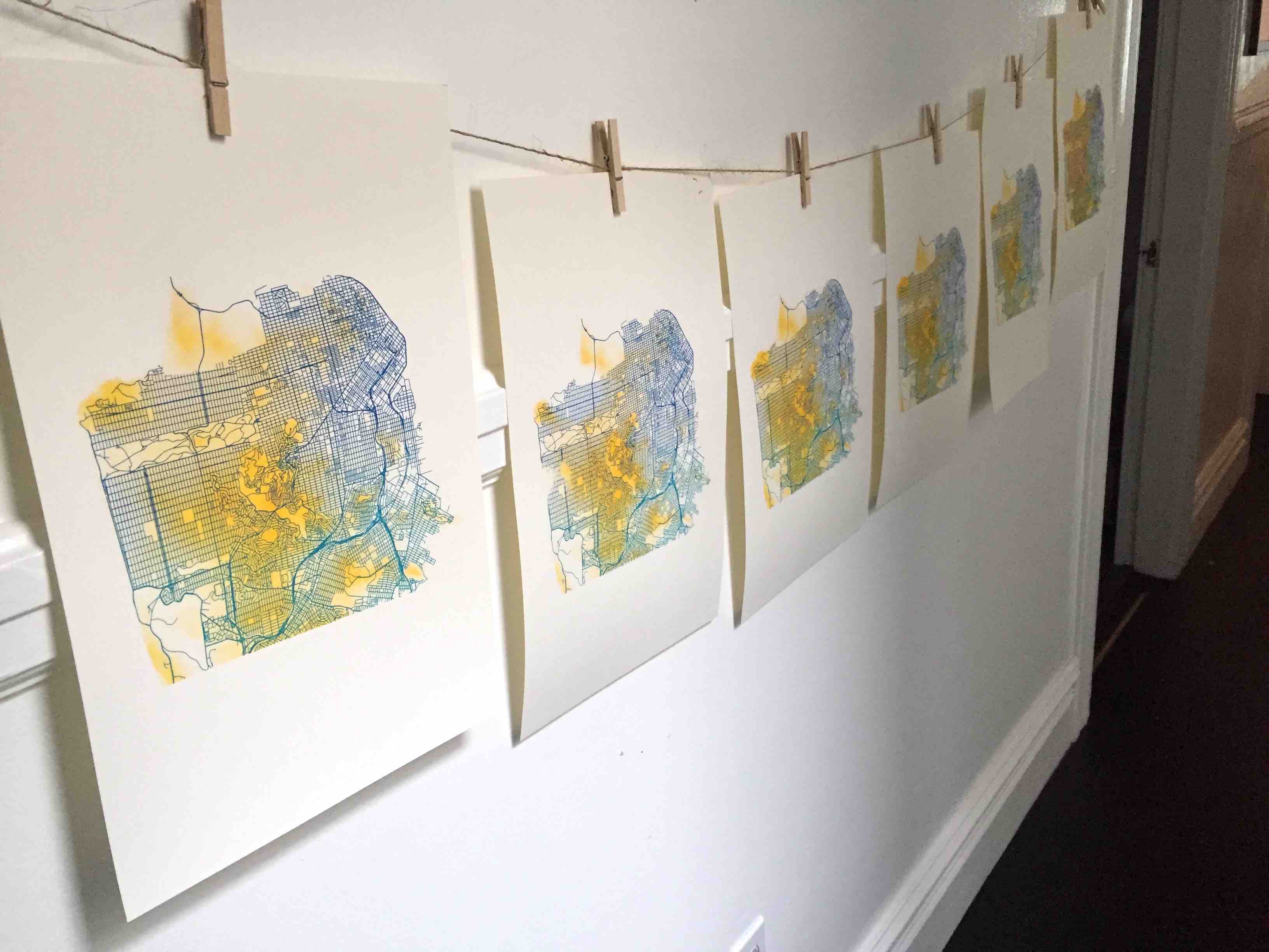
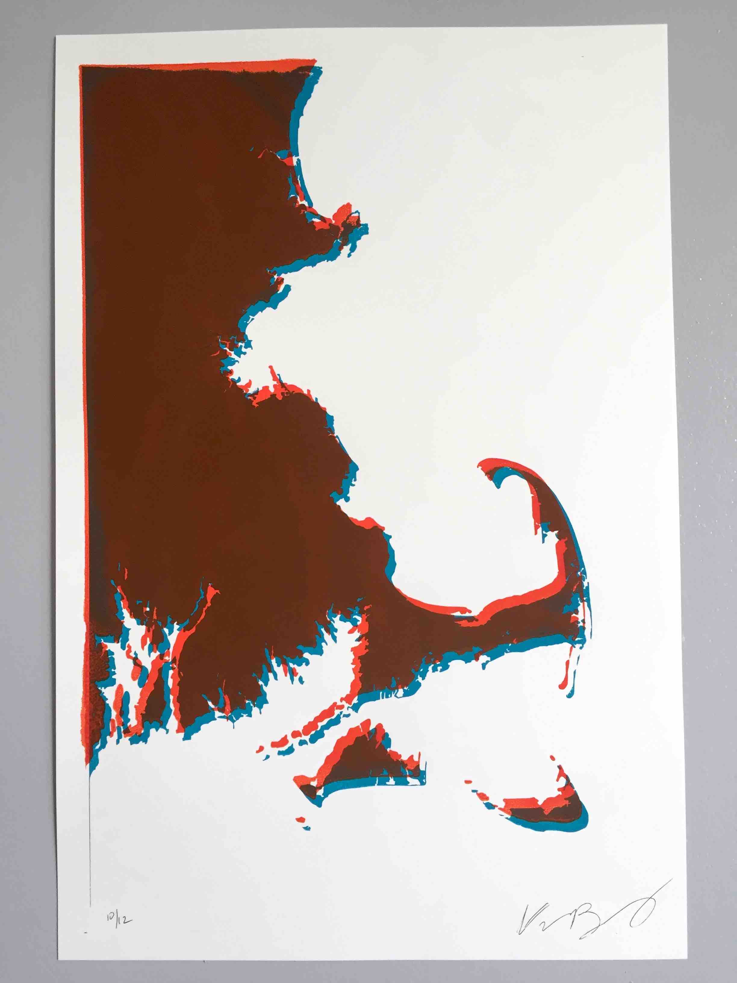
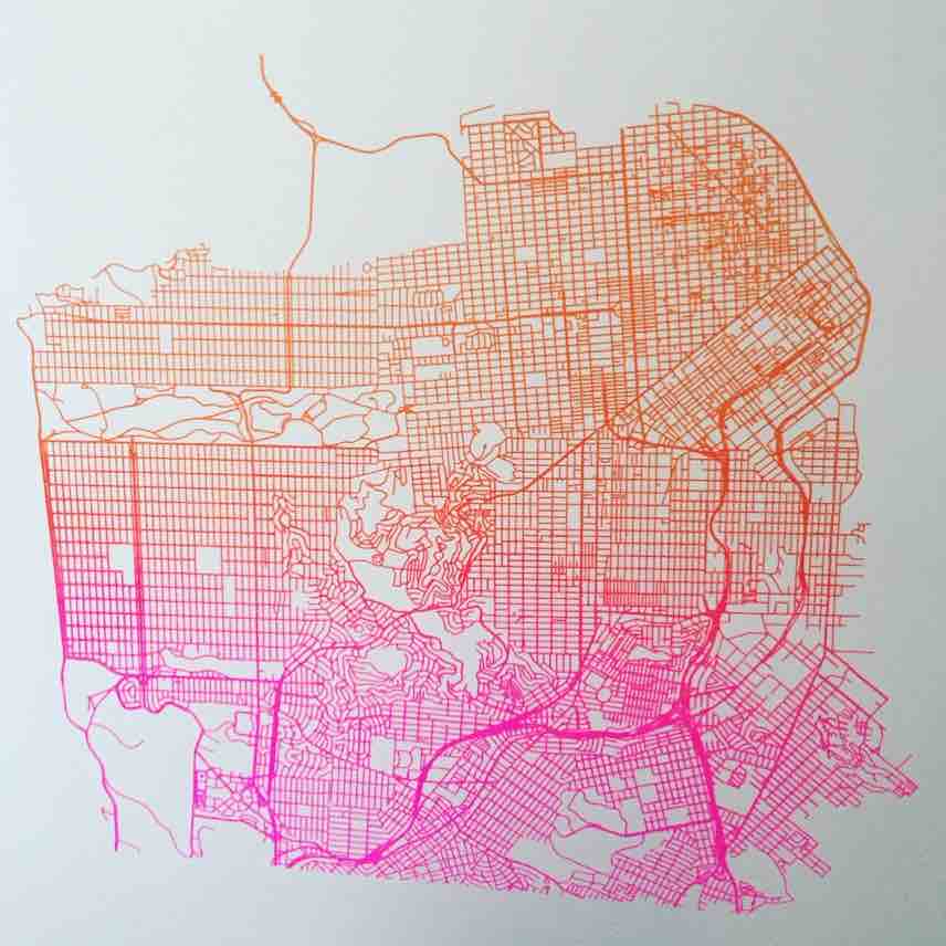
Interesting effects like color gradients (or "split fountain prints") can be created by mixing multiple colors when printing in order to generate a fade effect (see San Francisco Streets Screen Print). For Cape Cod Retro I printed the first layer blue, and then slightly offset the screen for the orange print, which creates this trippy overlay where the two align and misalign. For San Francisco Streets + Elevation I laid down an elevation layer first using a technique called "halftones", which uses the density of points to shade, here representing elevation--so the closer together the dots, the higher the elevation. I then overlaid the streets layer with a color gradient to finish off that map.
The screen printed maps have an interesting texture to them as the ink sits on top of the paper in a unique way (the raised dots of the halftones feel really cool). Each screen printed map is slightly different from the others because of the manual process, creating one of a kind pieces.
Work: Data Management, GIS, Cartography, Screen Printing
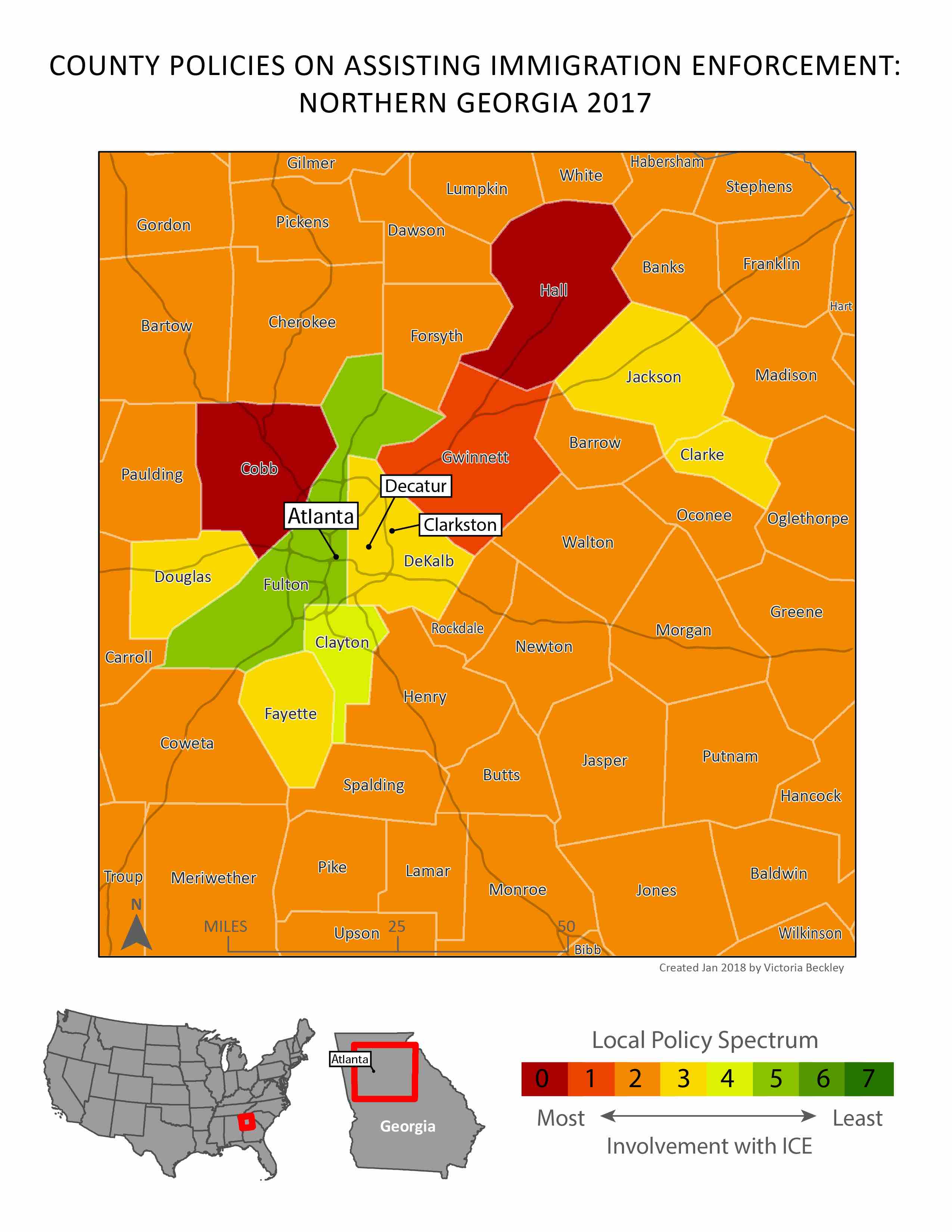
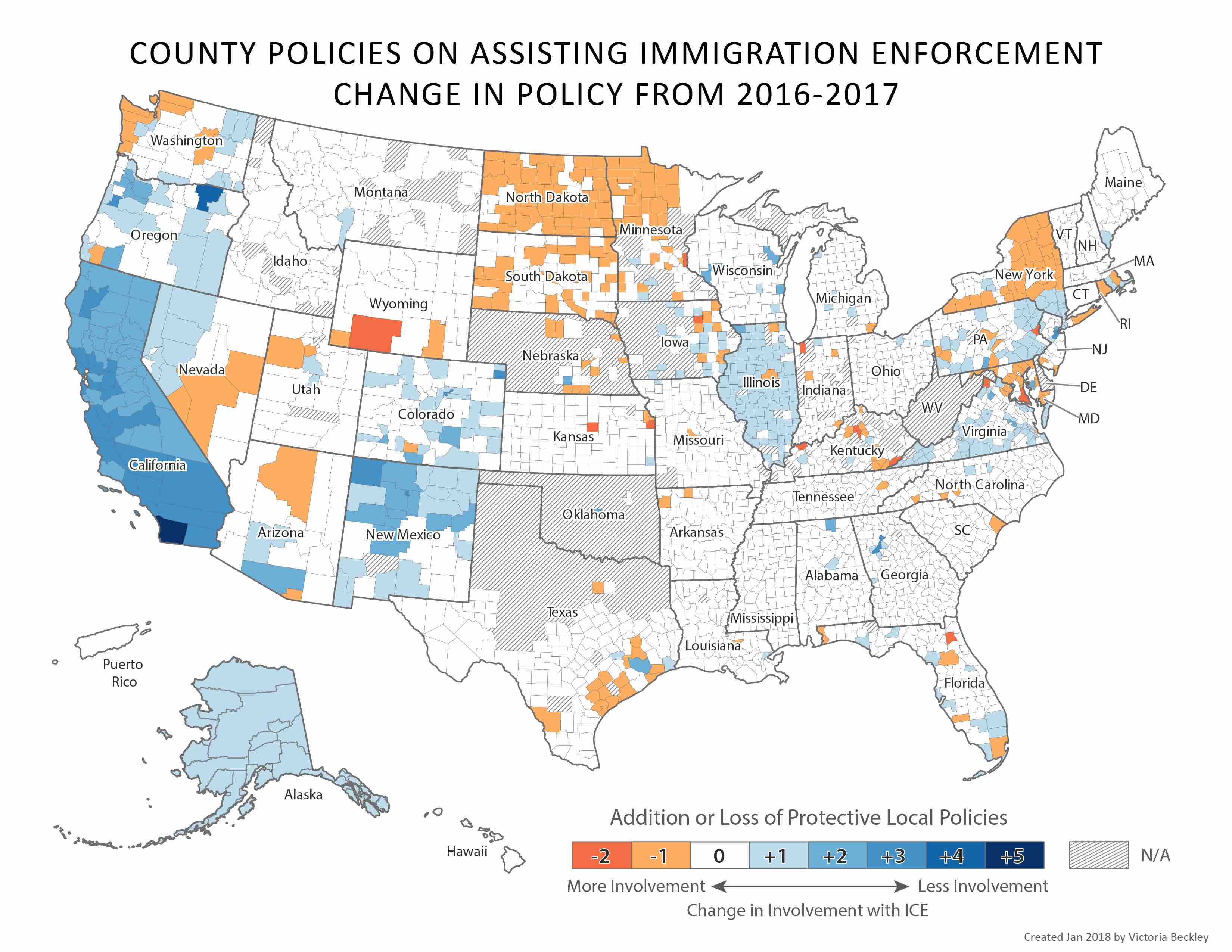
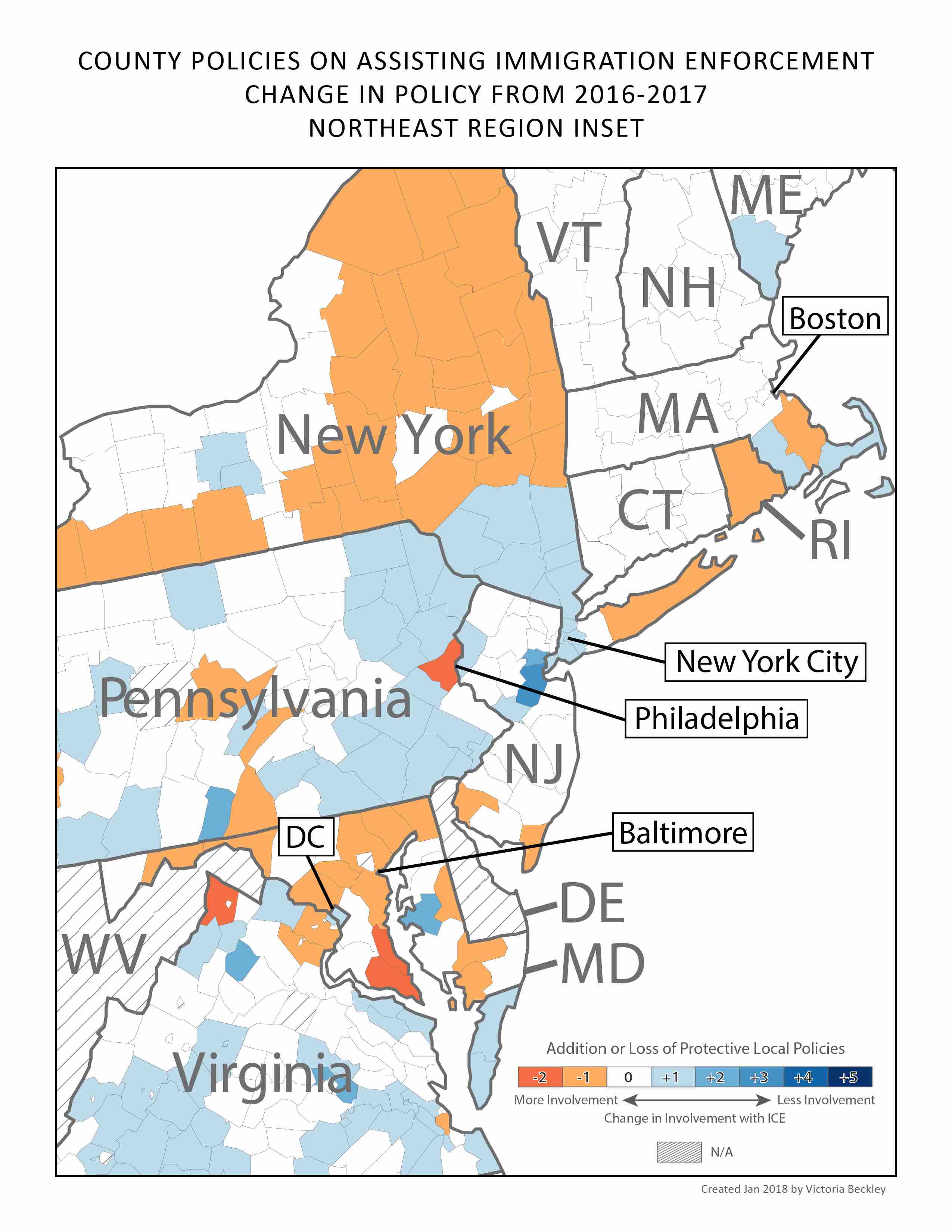
Mapping Immigration Policies by County
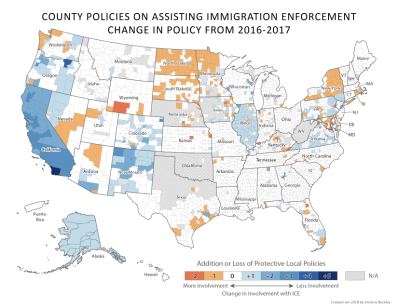
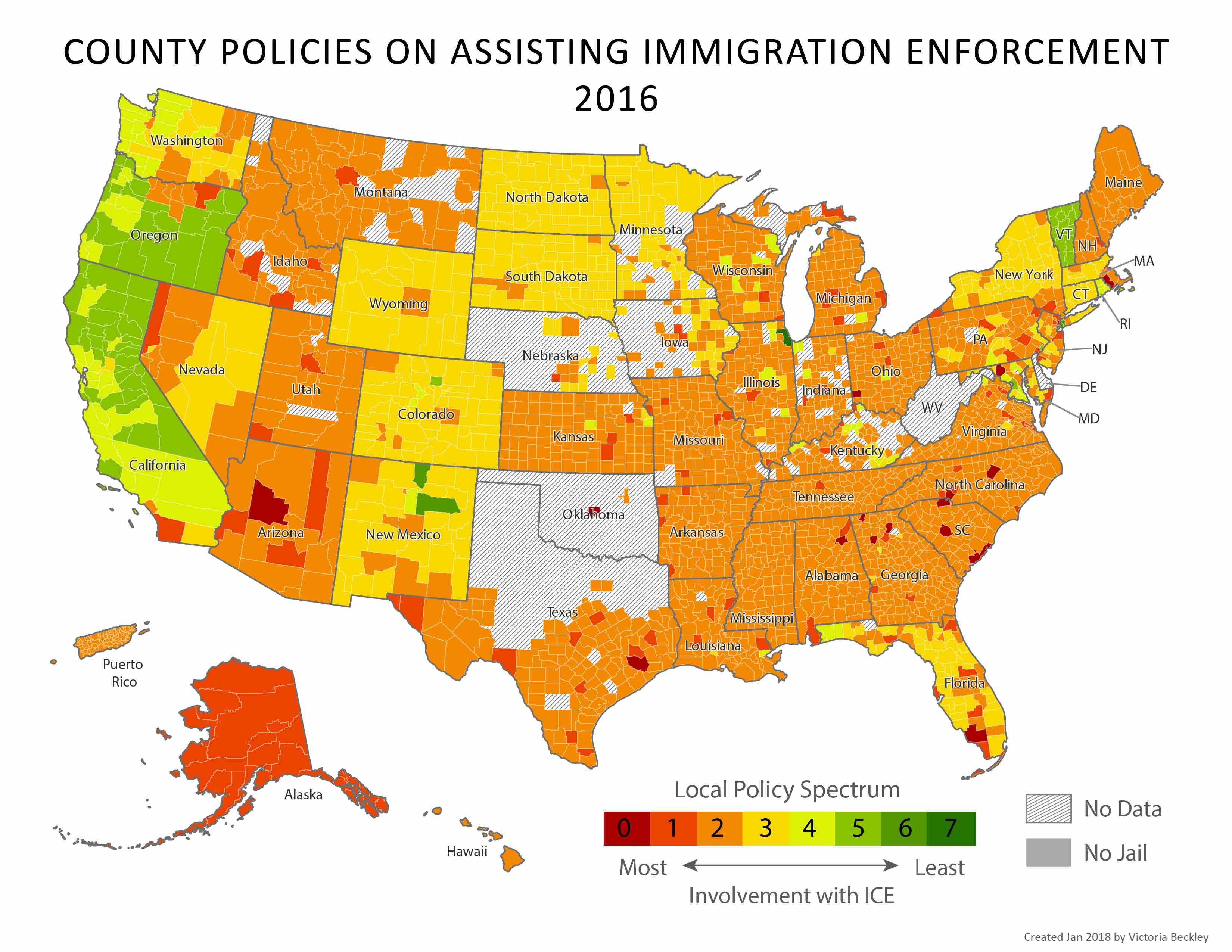
I collaborated with Immigration Legal Resource Center (ILRC) to contribute maps to their 2017 and 2018 reports on county policies pertaining to Immigration Enforcement across the country.
In the 2017 report Searching for Sanctuary the maps focused on policy trends across the county, with a few maps dedicated to specific areas of high contrast, like the City of Santa Ana within Orange County.
In the 2018 report, The Rise of Sanctuary, (featured in this City Lab article) the maps focused on county policy pertaining to Immigration Enforcement using the same rating system as in the previous report, but this time looking at both the current state of policies as well as the difference from the year before. National trends and local phenomena were highlighted, included high contrast areas like the counties around Atlanta, as well as the Northeast coast.
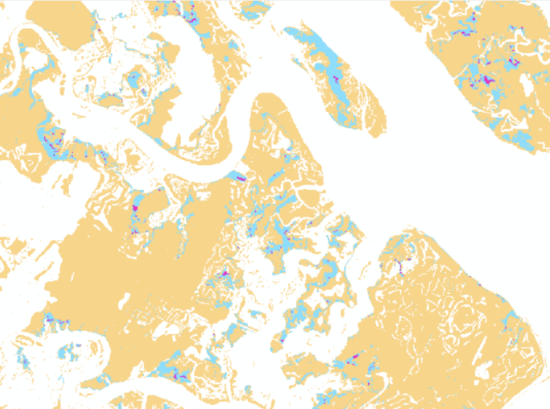
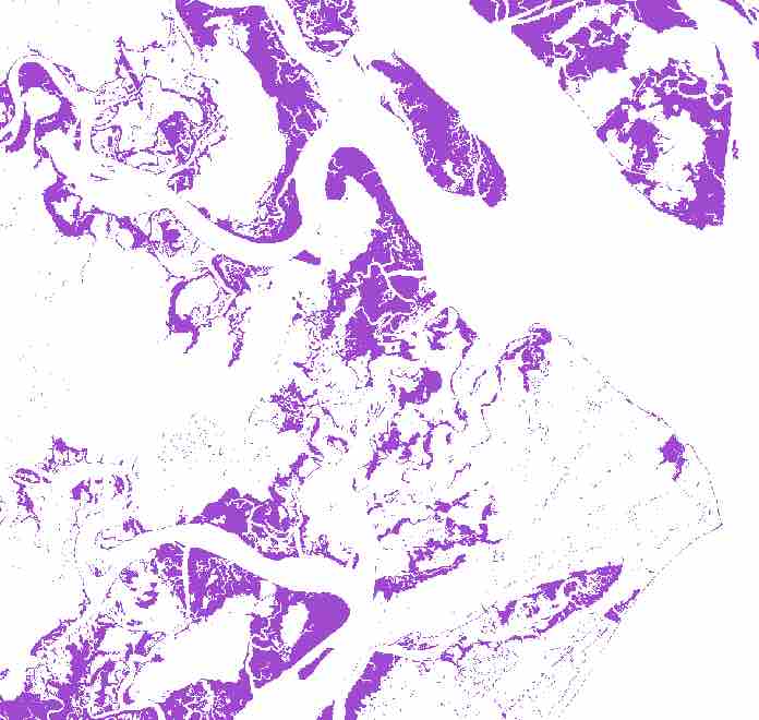
The Audubon South Carolina is interested in identifying land most conducive to future marsh migration for conservation purposes, and in 2015 contracted me to map these areas. The project overlaid four inputs to identify areas of highest and lowest likelihood of future marsh. These layers included landcover based on sea level rise, change in landcover using IPCC scenario predictions, soil data, and hardened shoreline features. The results helped inform the Audubon's land acquisition efforts.
Input raster of marsh landcover from NOAA's Sea Level Rise and Coastal Flooding Impact Landcover and input vector data of soil coverage from South Carolina Department of Natural Resources
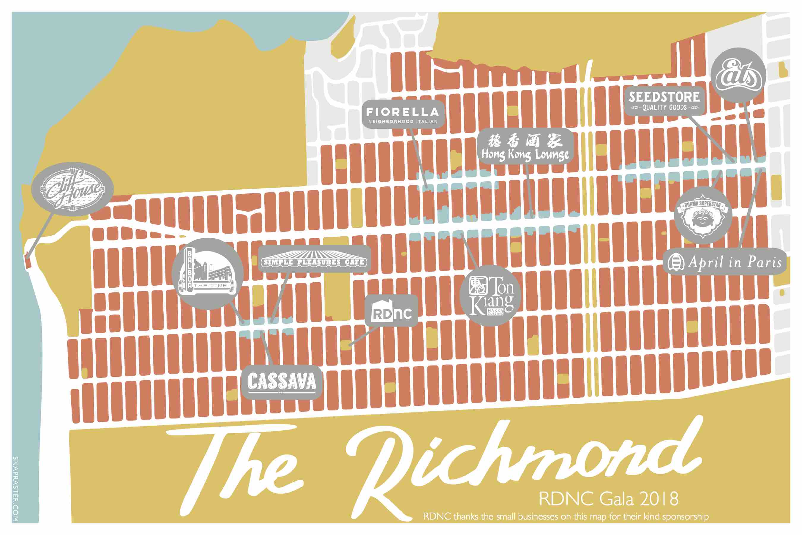
The Richmond Neighborhood Center (formerly Richmond District Neighborhood Center (RDNC)) commissioned me to make a commemorative map that was given to guests of their 2018 fundraising Gala. The map highlighted the sponsors of the event as staple local businesses that help define the Richmond district.
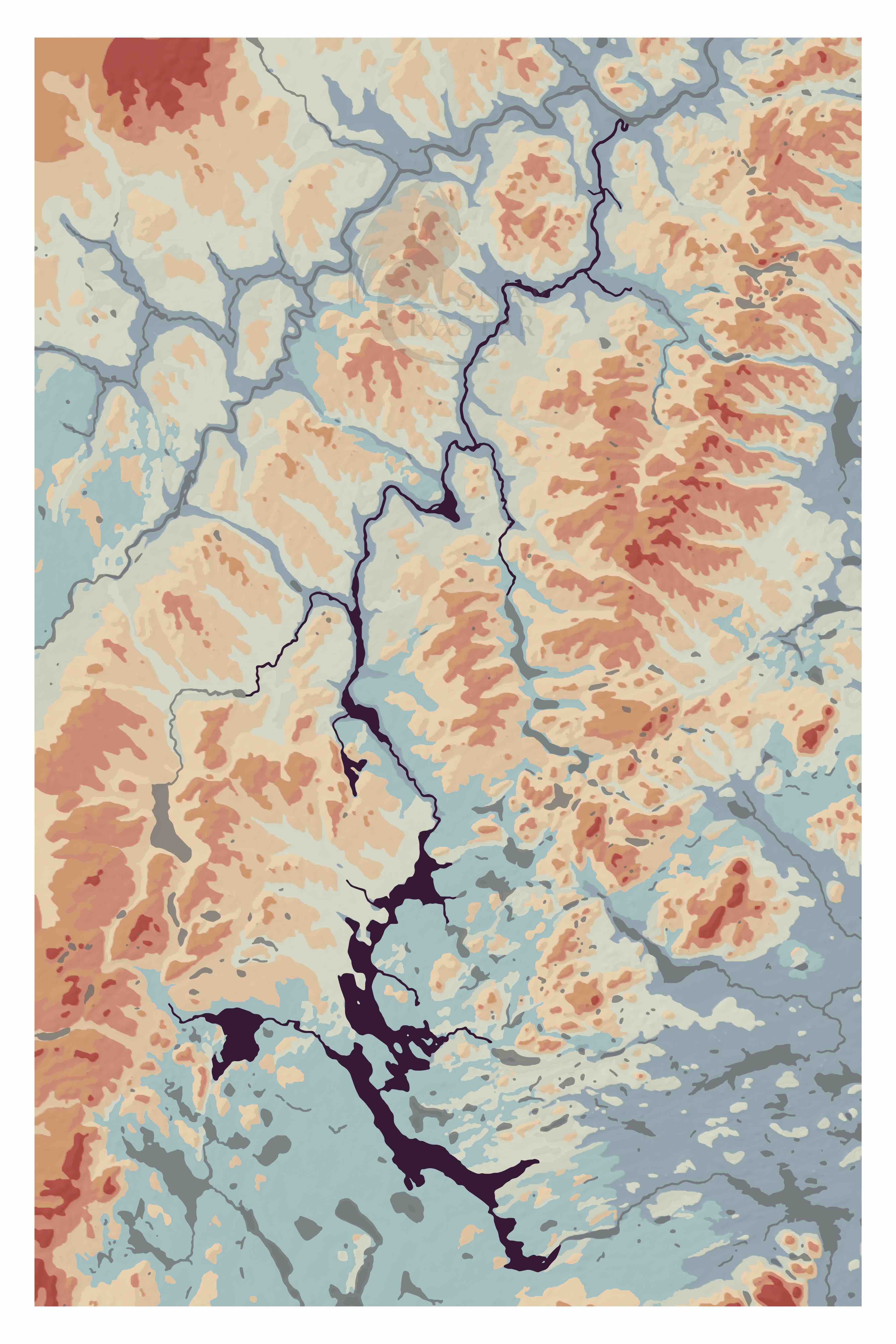
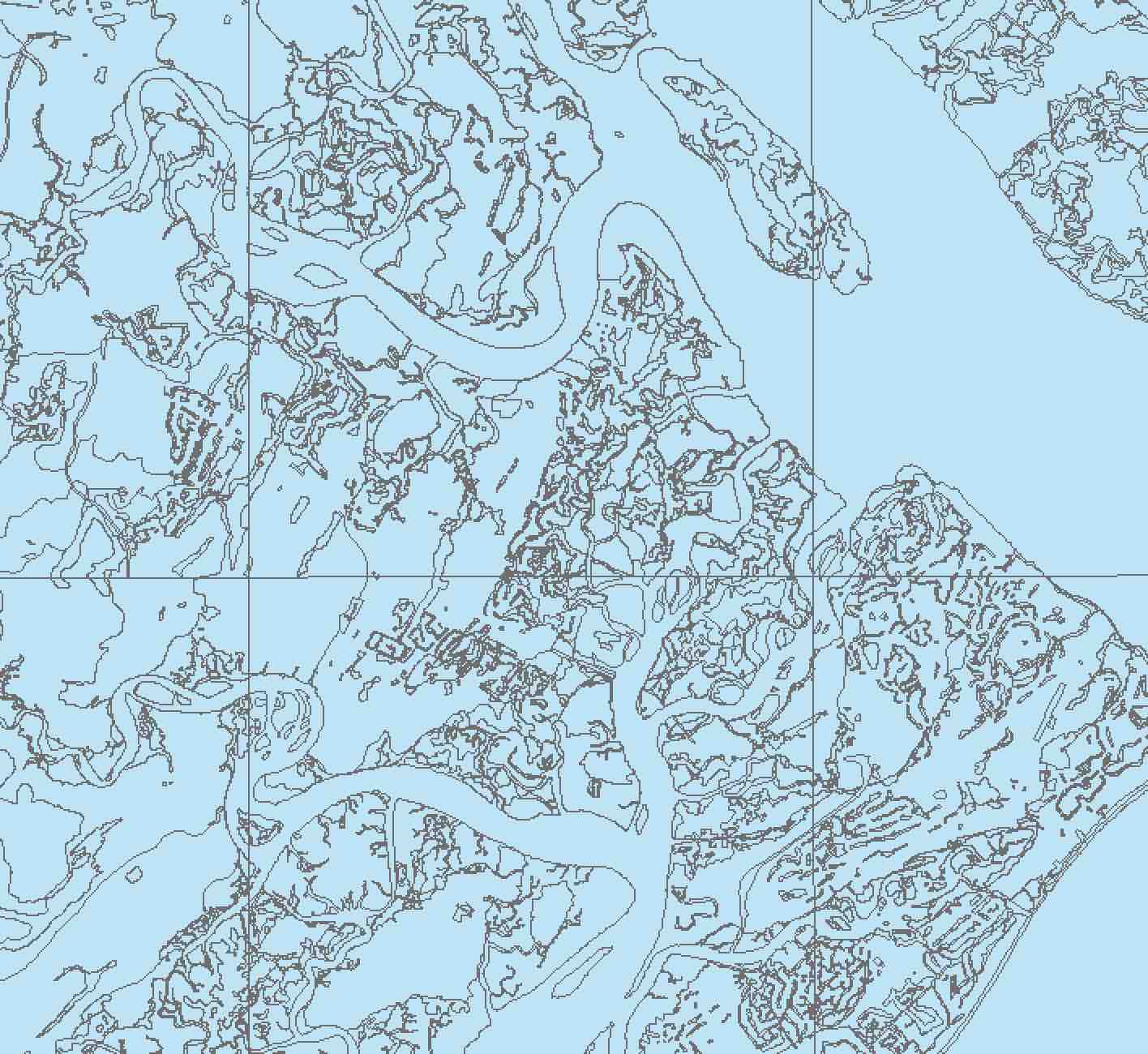
I made this map for my friend's dad who leads an annual kayaking trip down the Allagash. The map's focus in on the river so that those familiar with it can recognize locations based on its bends and forks, I also included the surrounding elevation (topography) for context and color. The topography is visualized using a digital elevation model (DEM) from the Maine Office of Geographic Information Systems. I classified and colored the DEM and then generated a hillshade to overlay, helping distinguish the valleys and ridges of the terrain.
This map uses a digital elevation model (DEM) from the City of San Francisco to visualize the highest point above sea level on each building in the city. This allows viewers to recognize skyscrapers in downtown as well as hills and valleys across San Francisco. I used the DEM to assign values to the buildings using the maximum z value within the building footprint's extent. I then assigned a range of colors to these values to indicate the elevation, the highest point on the spectrum representing 1776 feet at Sutro Tower, and the lower point at 8 feet, in Hunters Point.
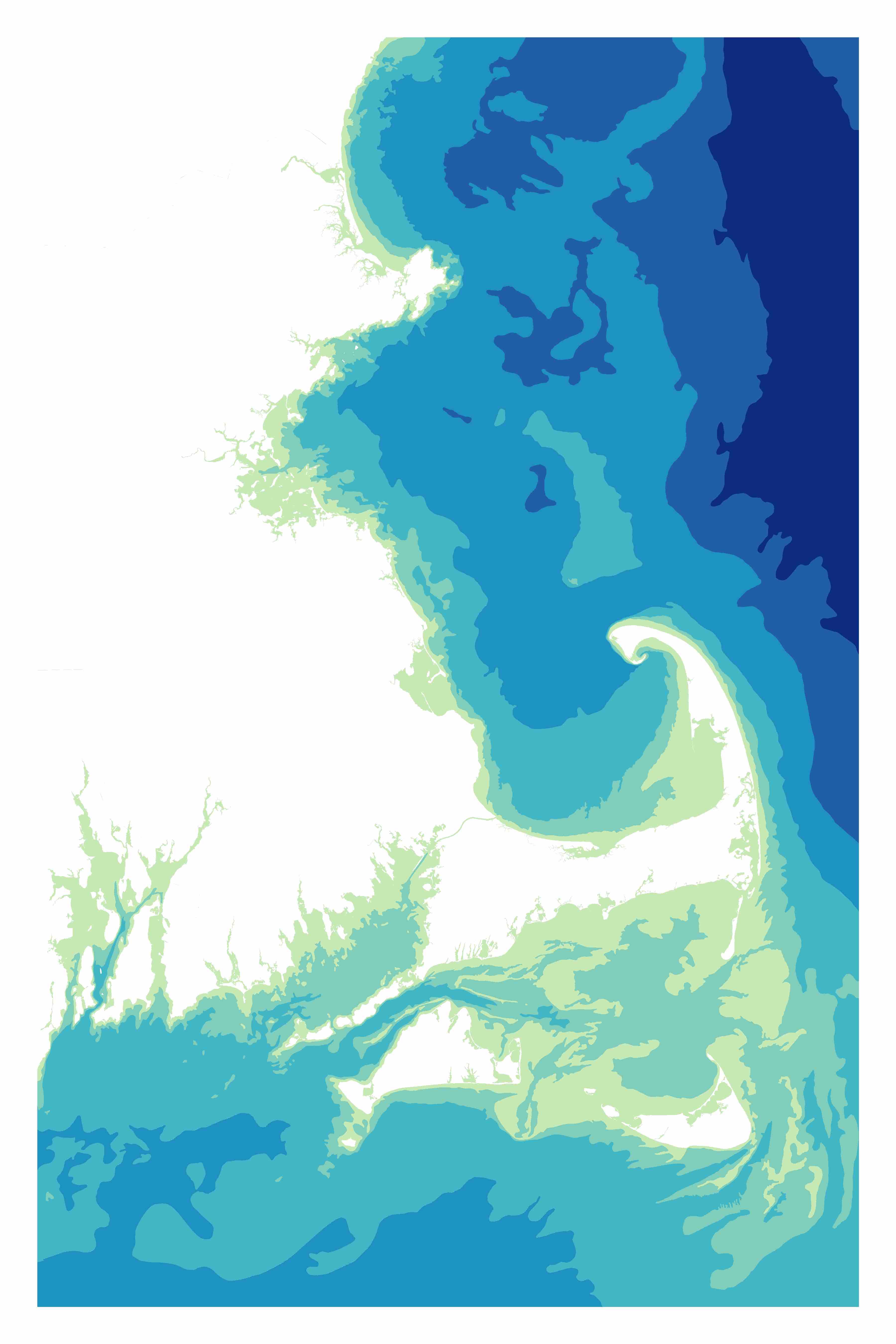
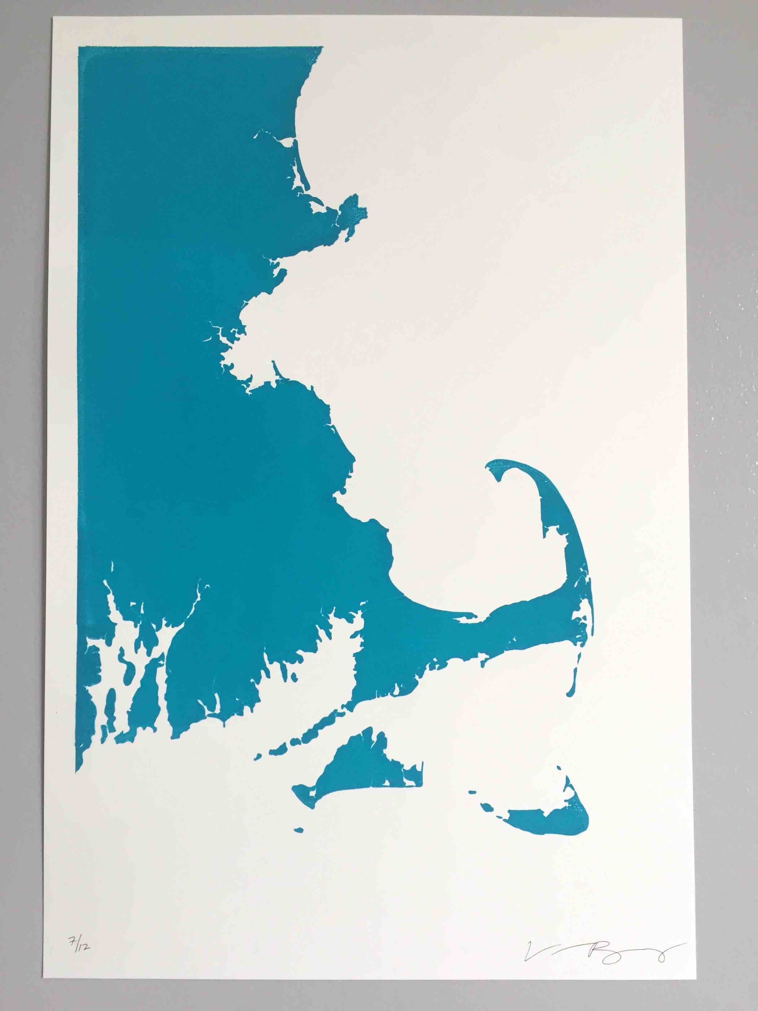
I wanted to map the coastline of Cape Cod because of its unique shape that defines Massachusetts.
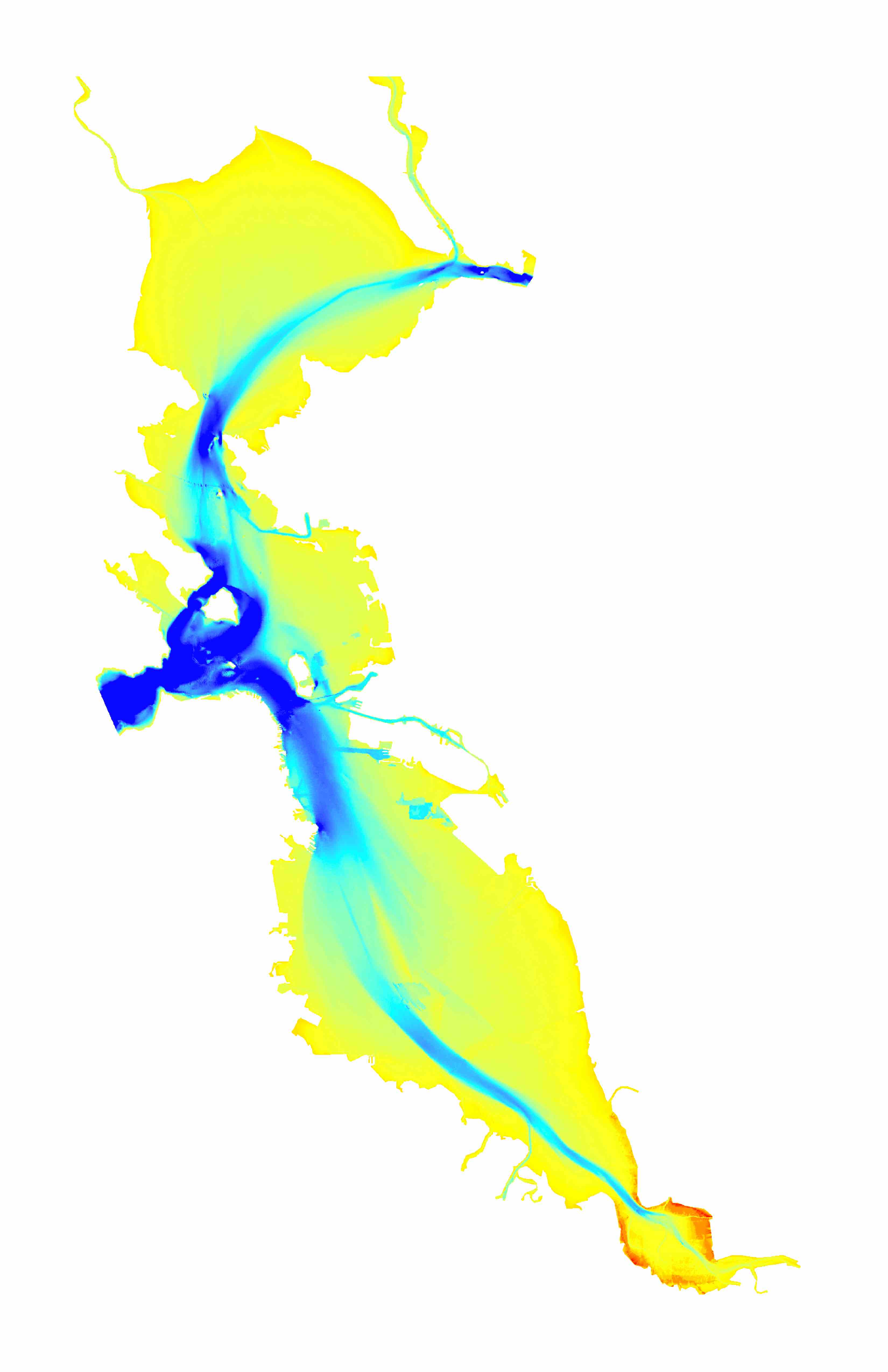
This map illustrates the Atlantic Ocean using various color spectrums to show water depth, or bathymetry.
This allows viewers to use the water to identify coastal features along Cape Cod, Nantucket, the Vineyard, and Boston Harbor.
I also made this map as a screen printed single layer map: As well as a two layer print with a small offset to create an effect:
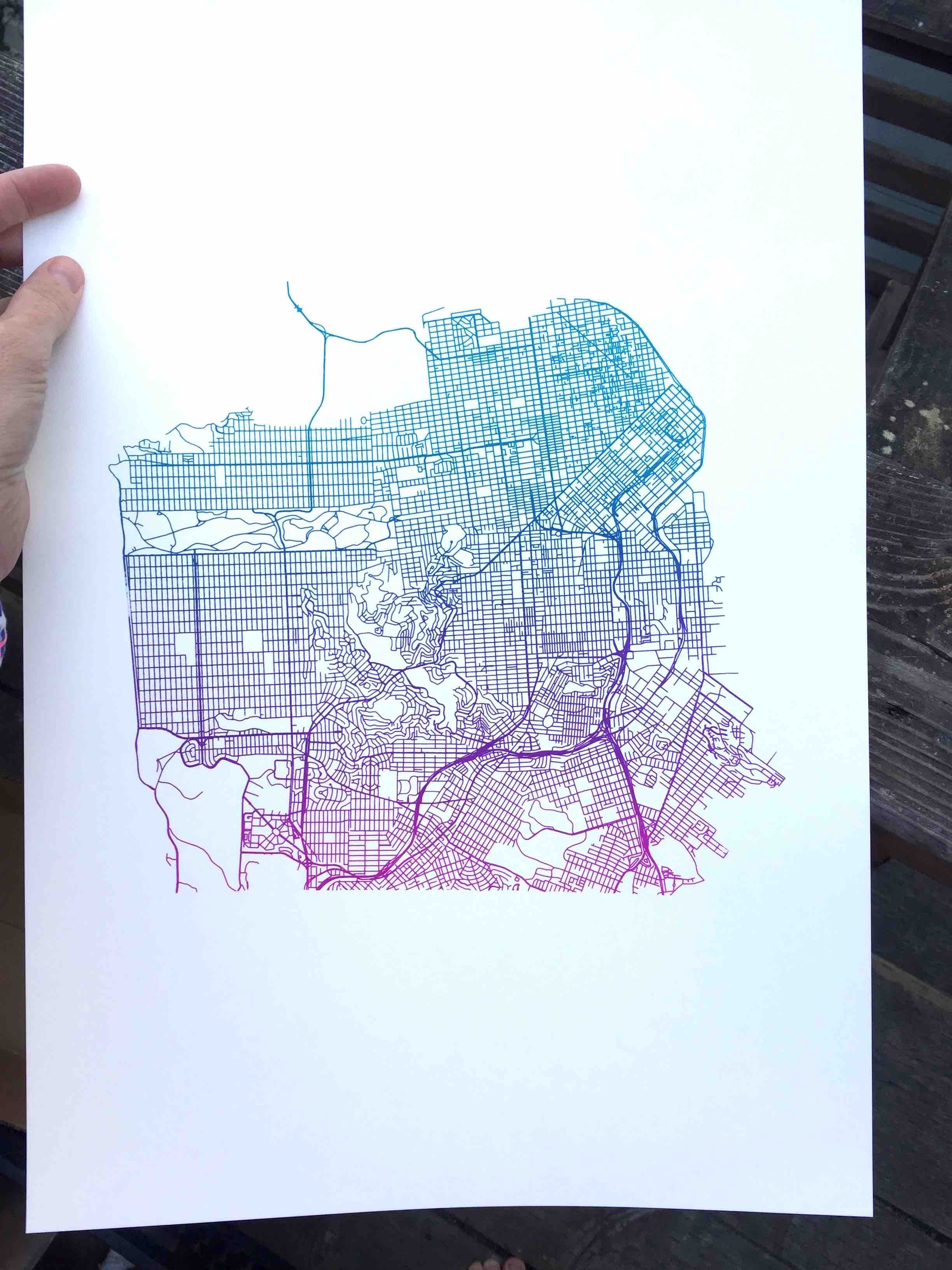
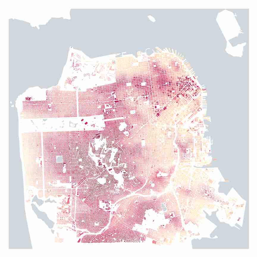
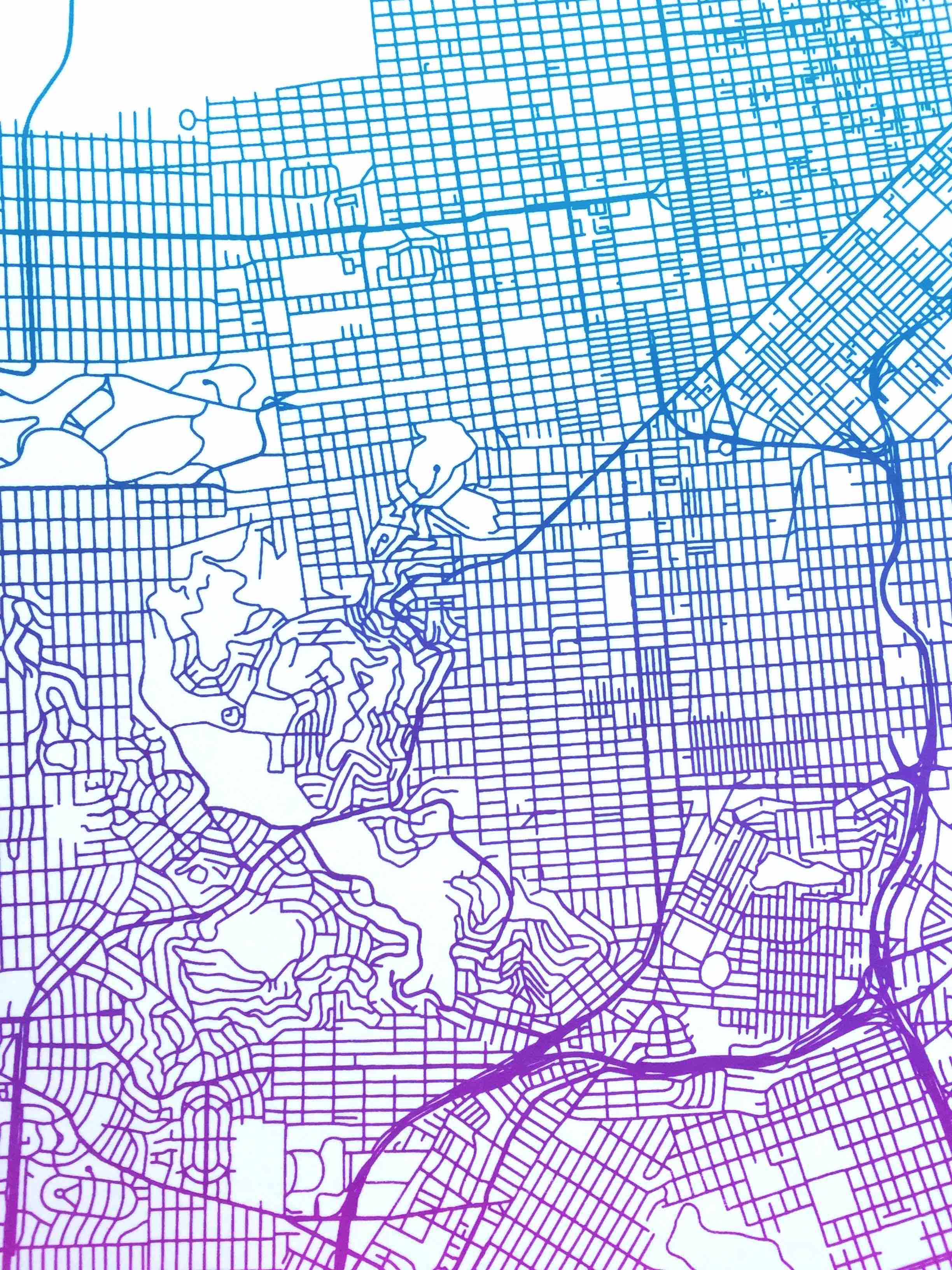
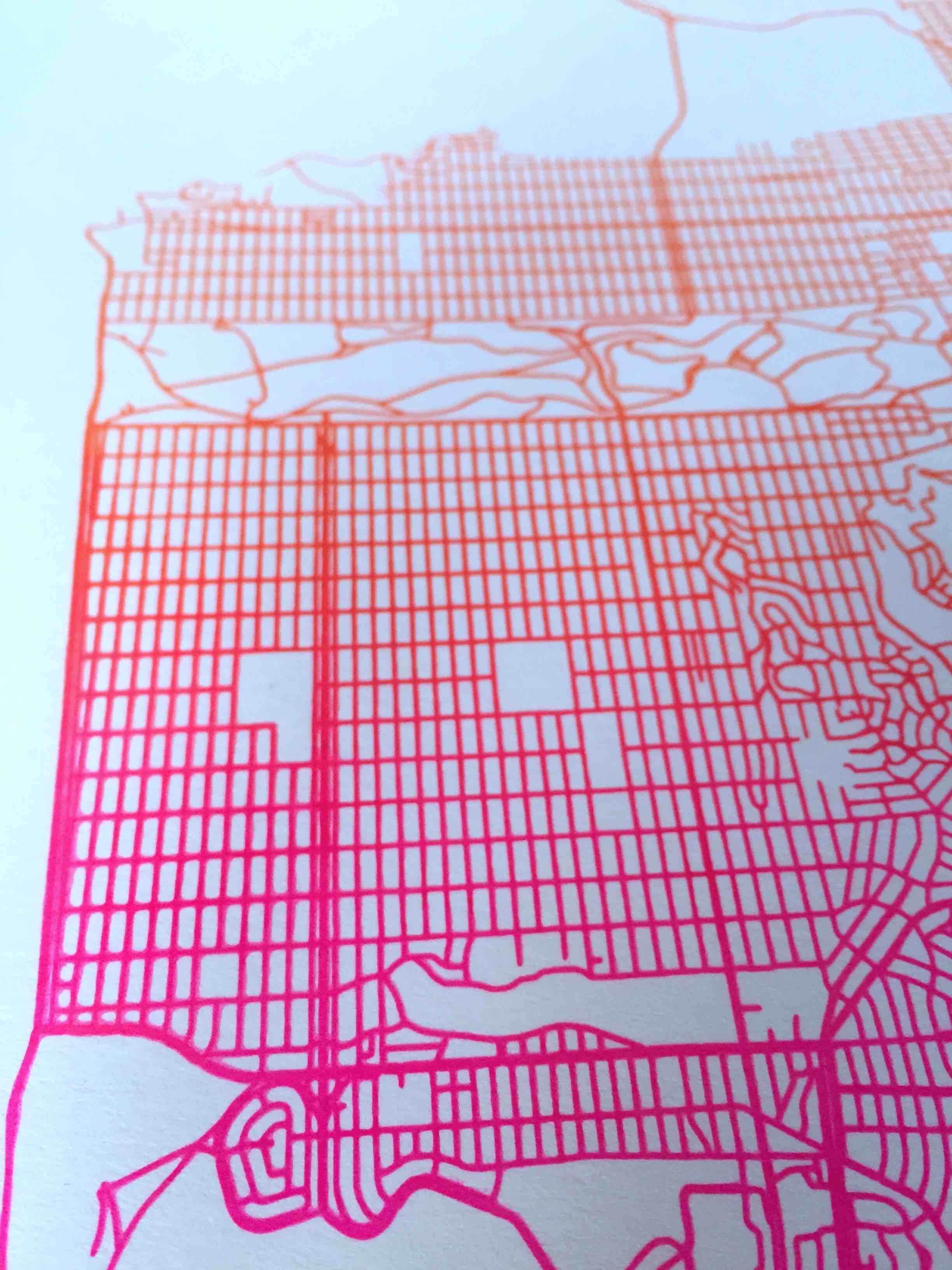
This is a screen print of the streets of San Francisco, done using a color gradient, or split fountain, printing technique. I am particularly drawn to the streets because their shape helps convey the hills, windy streets indicate steep areas, while straight lines are typically flat areas.
Date: 2018
Services: Cartography, Screen Printing
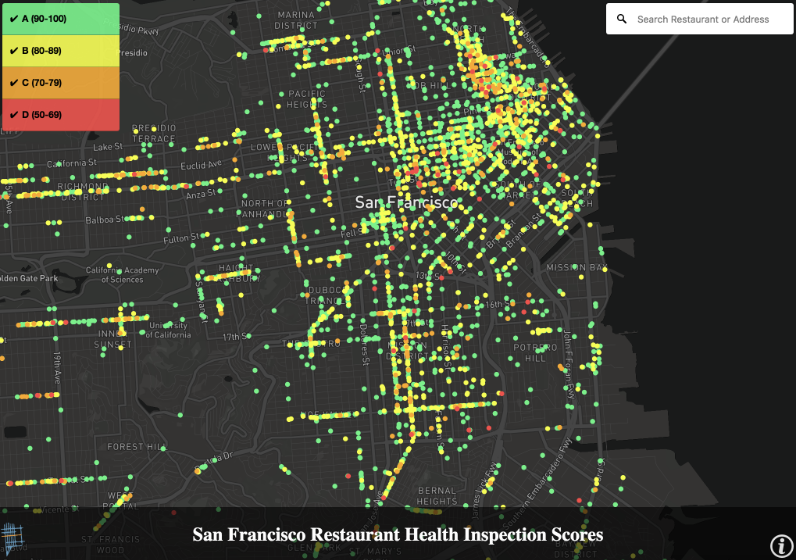
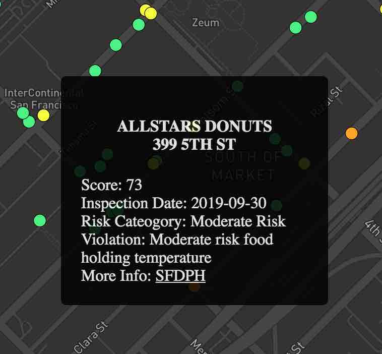
San Francisco Restaurant Inspection Score Lookup
This map was created for Mission Local to make current restaurant inspection scores more accessible to residents (see this article on the lack of transparency in restaurant scores in SF).
The map uses a live feed of the City of San Francisco's restaurant inspection scores that shows only the most recent inspection score for each restaurant.
Restaurants can be filtered by scores and more information can be found by clicking on a restaurant point to reveal inspection date, first listed violation, and a link to the complete inspection record for the restaurant.
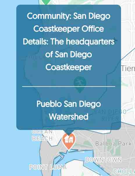
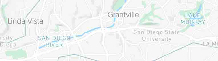
This map was made for San Diego Coastkeeper to visualize watersheds in the San Diego region to help inform locals of the watershed in which they work and live in order to encourage protection of water bodies.
The map includes local points of interest identified by San Diego Coastkeeper to help contextualize the watersheds with natural assets and on-going conservation projects.
Each point of interest can be identified on the backend as either a filterable icons with a popup window with more information (as seen above) or as labels in the map that integrate visually with the default labels found on the basemap, like the San Diego River and Lake Murray seen below.
These points of interests are categorized into groups like protected bodies of water and public land, as well as Coastkeeper's conservation projects.
These categories determine how the label looks in the basemap for points marked as labels, and for points marked as icons it determines the look of the icon and adds the point to the filters at the bottom of the map (as seen below).
A multiyear collaboration with a Bay Area community land trust, Richmond LAND, to develop a system for locating, transforming, and visualizing spatial data about the housing landscape in Richmond, CA.
Richmond LAND works to help keep community members in place by advancing anti-displacement policy at the city level and by moving properties into the community land trust to be controlled by the community and held as permanently affordable housing for Richmond residents.
Data analysis and mapping supports the effort of Richmond LAND staff and their community collaborators to answer housing questions, promote their policy campaigns, and help identify sites for ac-rehab.
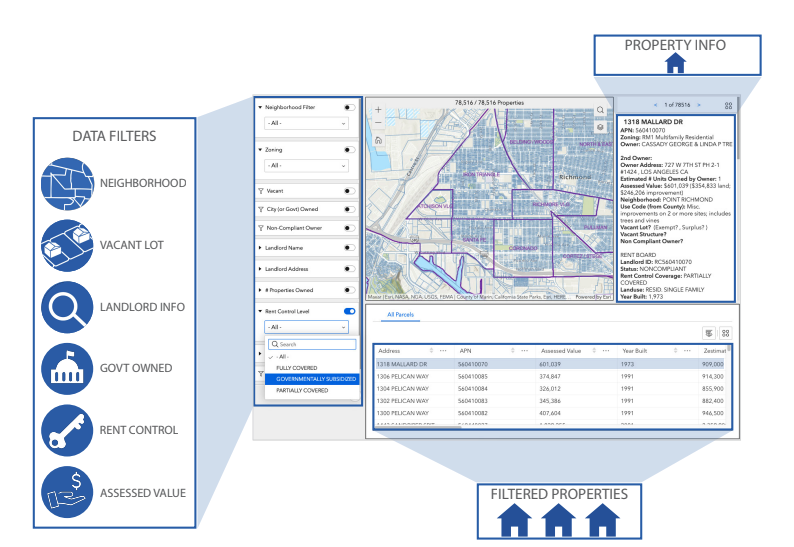
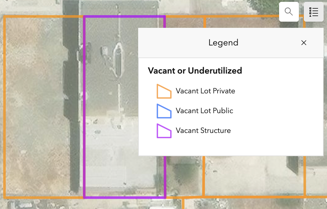
We created a site suitability tool to help staff identify properties that might be suitable to acquire and rehabilitate into the land trust. This tool includes abilities to filter properties using vacancy status, ownership type (city or private), assessed value, number of properties owned, owner location (Richmond, outside Richmond, different state), and owner non-compliance (might signal negligent landlord).
This tool helps Richmond LAND identify potential opportunities to acquire a property at a less competitive cost (typically due to landlord negligence) and identify sites where tenants might be most in need of intervention (also often times due to landlord negligence and/or attempts to displace tenants). This work also includes producing visuals for various research and campaigns. Including in depth property lookups for sites being considered for acquisition and maps of properties within a half mile of current "pipeline" housing developments underway (shown above).
Additionally, we've produced interactive visual tools for exploring tax delinquent properties, vacant sites, and city owned properties in Richmond to assess low-cost acquisition feasibility. Screenshots from the vacancy viewer are shown above.
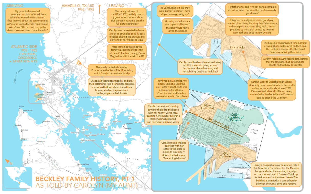
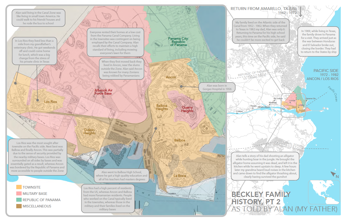
This family history project is an exploration of my father's upbringing in the Panama Canal Zone in the context of political history of the time. It interrogates the US presence in Panama as a colonial occupation masked as an economic and technological innovation for global progress.
The project shares my dad's and his siblings' stories of growing up in the Canal Zone as a representation of the US government's impressive ability to create an idyllic suburban experience for US expats in the Canal Zone that epitomizes how the US framed the Canal project to their people and the world.
This project is in four parts:
Print Map of my Aunt's stories from the Atlantic side (near Colon) during 1952-1962
Print Map of my dad's stories from the Pacific side (near Panama City) from 1972-1982
Print Map of the Flooding of Pueblos Perdidos in 1911 to make way for the canal
Interactive Map that details my family's stories alongside a historical and political narrative of the time
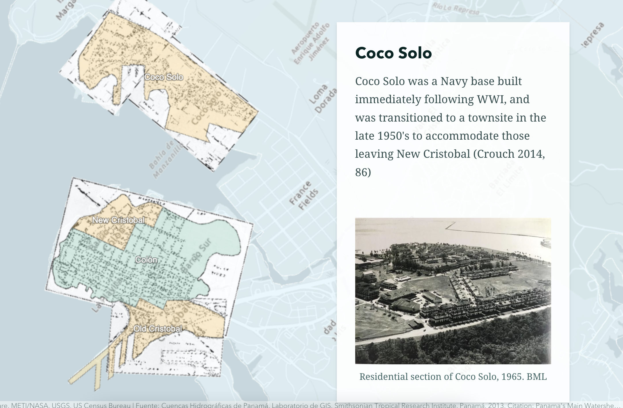
Atlantic Side 1952-1962
First, the map of my Aunt's stories from growing up on the Atlantic side near Colon:
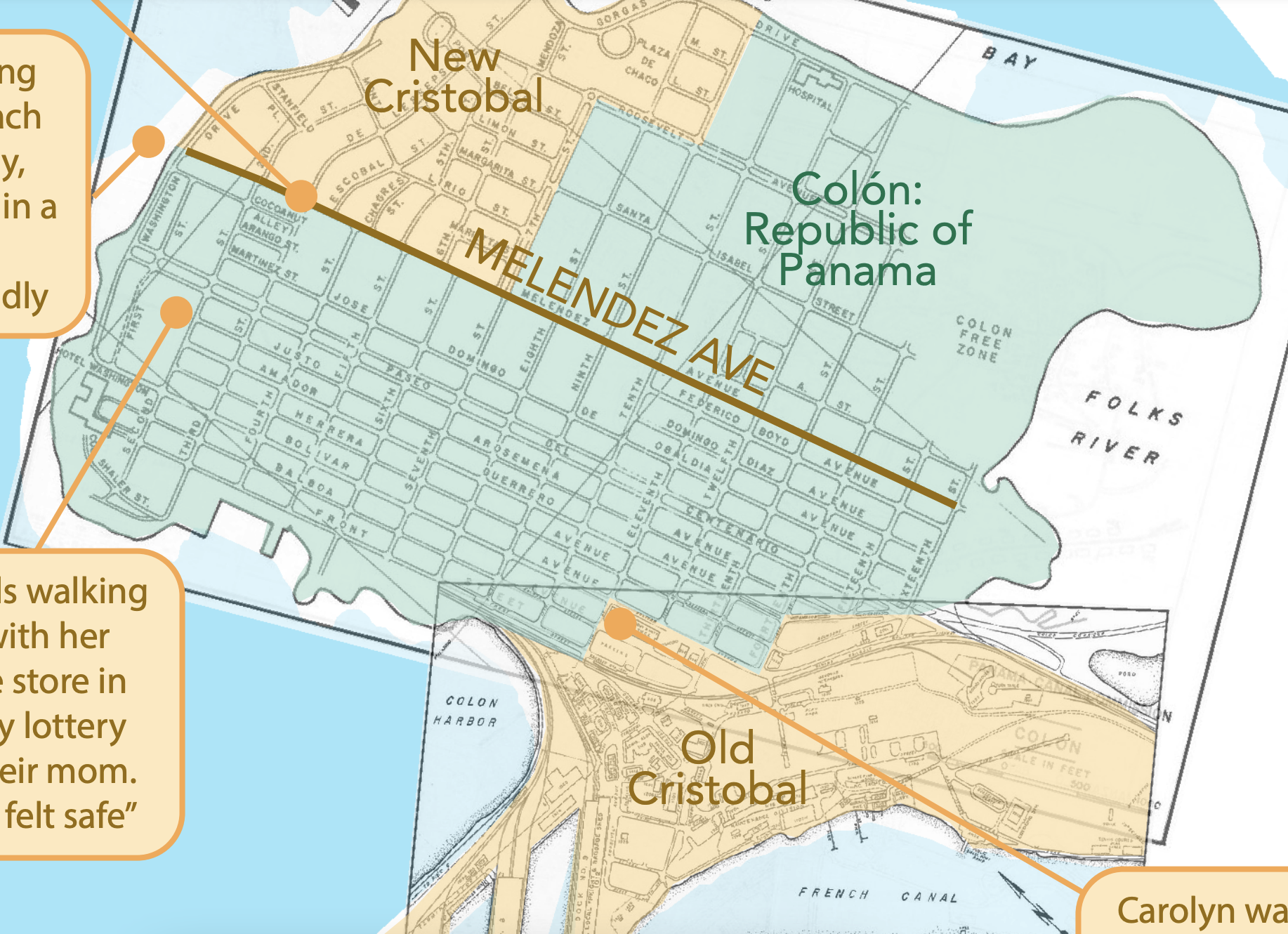
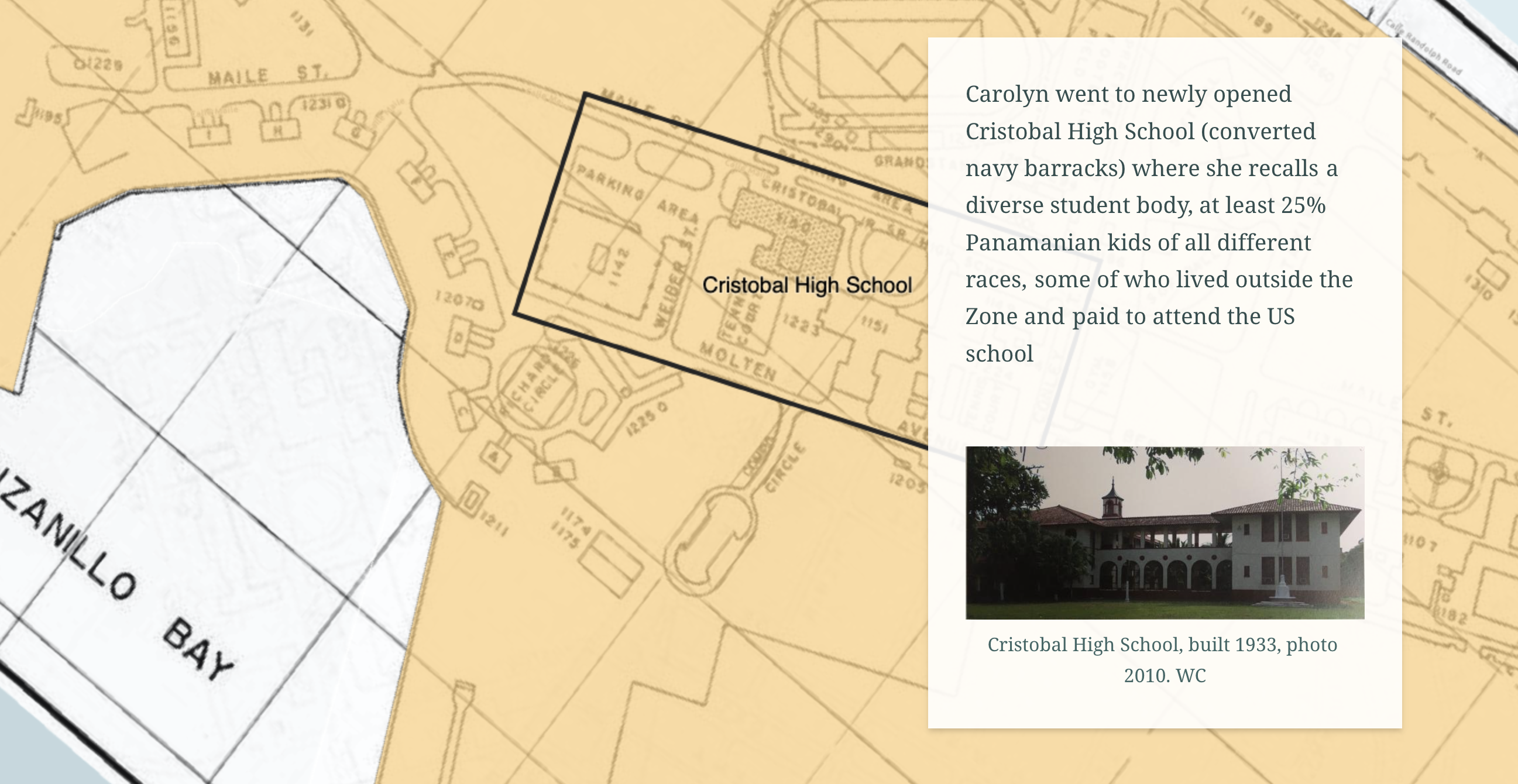
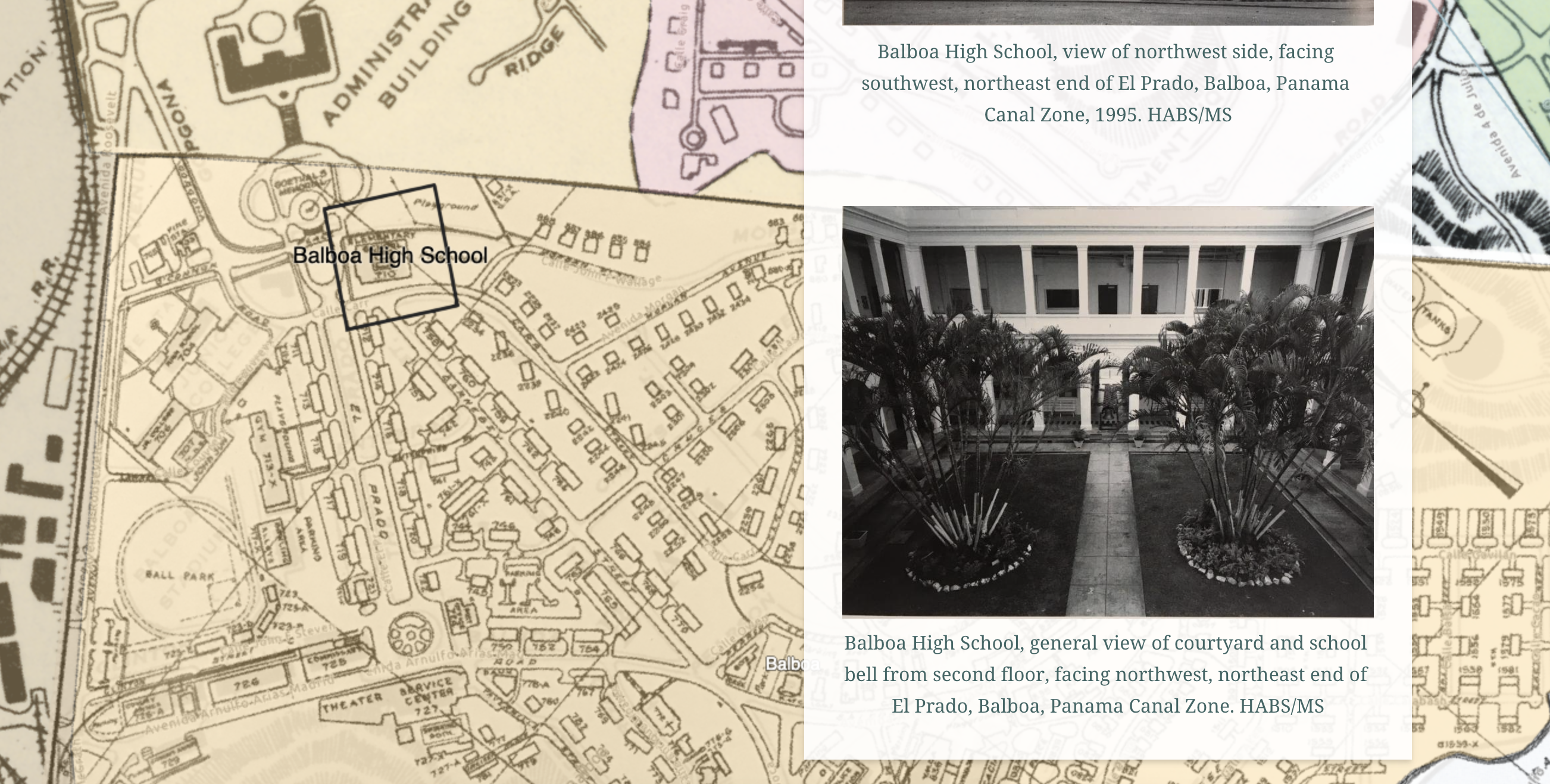
This map overlays old maps of the Panama Canal "townsites", which are shown in green and are towns owned and operated by the US government as part of its occupation of the Canal Zone with Panama's land shown in yellow and the modern geography of the area underneath. I used these maps alongside old images to locate sites from my Aunt's stories including Cristobal High School, which is shown with images from her graduating high school class in the interactive map (detailed below).
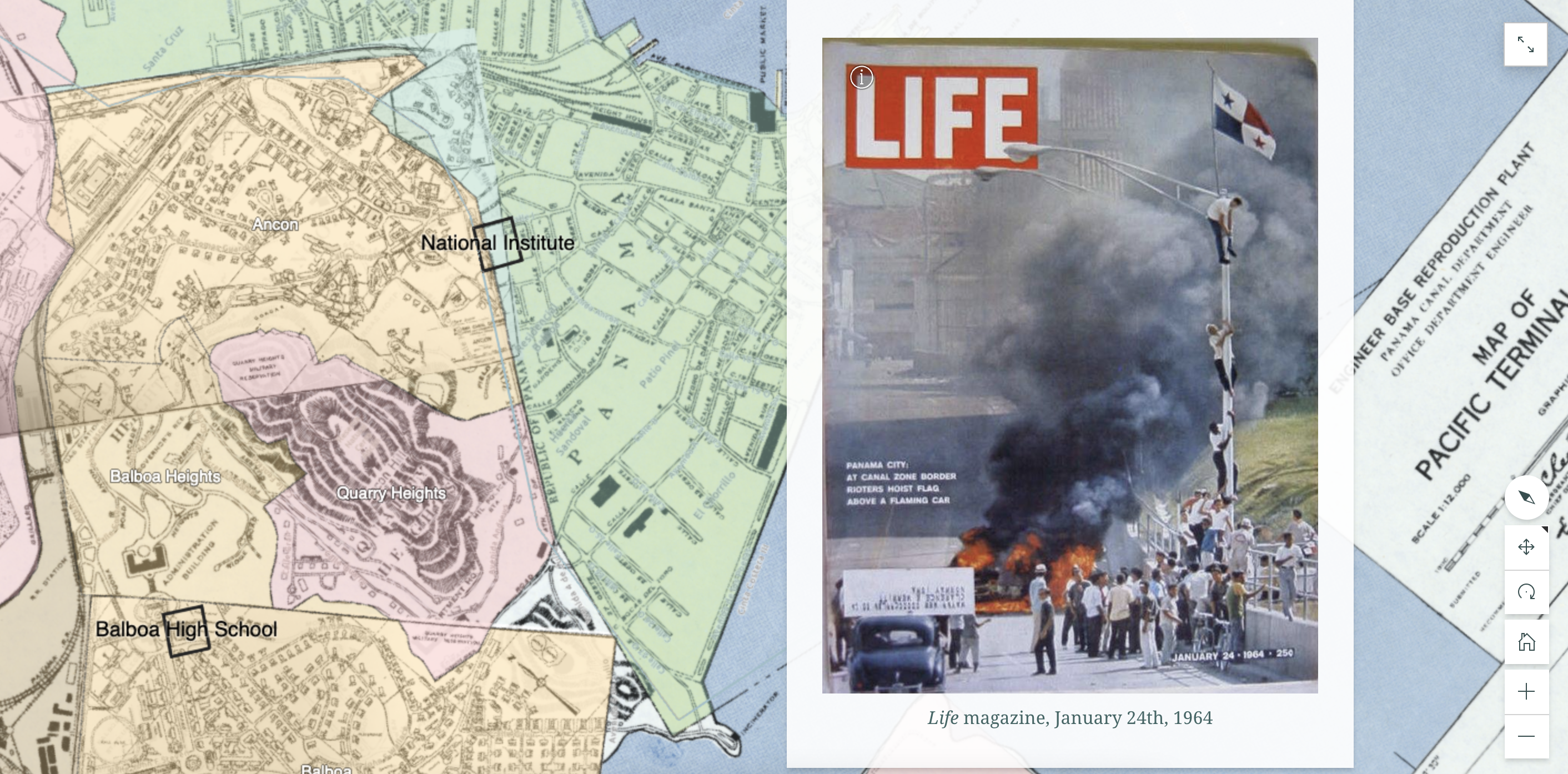
Pacific Side 1972-1982
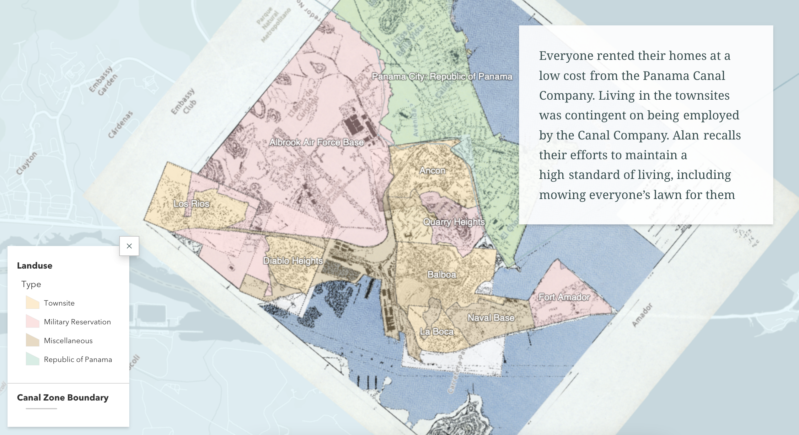
Next, the map of my dad's stories from growing up on the Pacific side near Panama City:
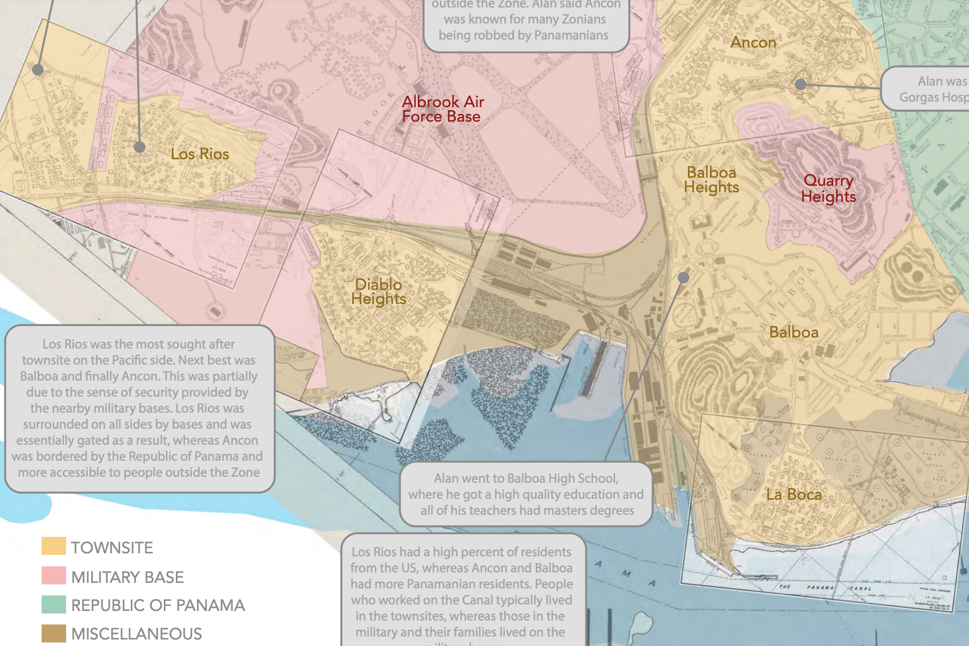
Here I patched together many townsite maps to piece together my dad's faint childhood memory of the various townsites in relation to one another. He described his family moving overtime to more desirable townsites, so mapping the townsites (shown in yellow) in the context of military bases (shown in red) and the fenced border with Panama City (shown in green) helped contextualize why areas were deemed valuable or not.
The narrative interactive map (described further down) digs into the significant political events that happened at this border during the time my family lived on the Pacific side of Canal Zone.
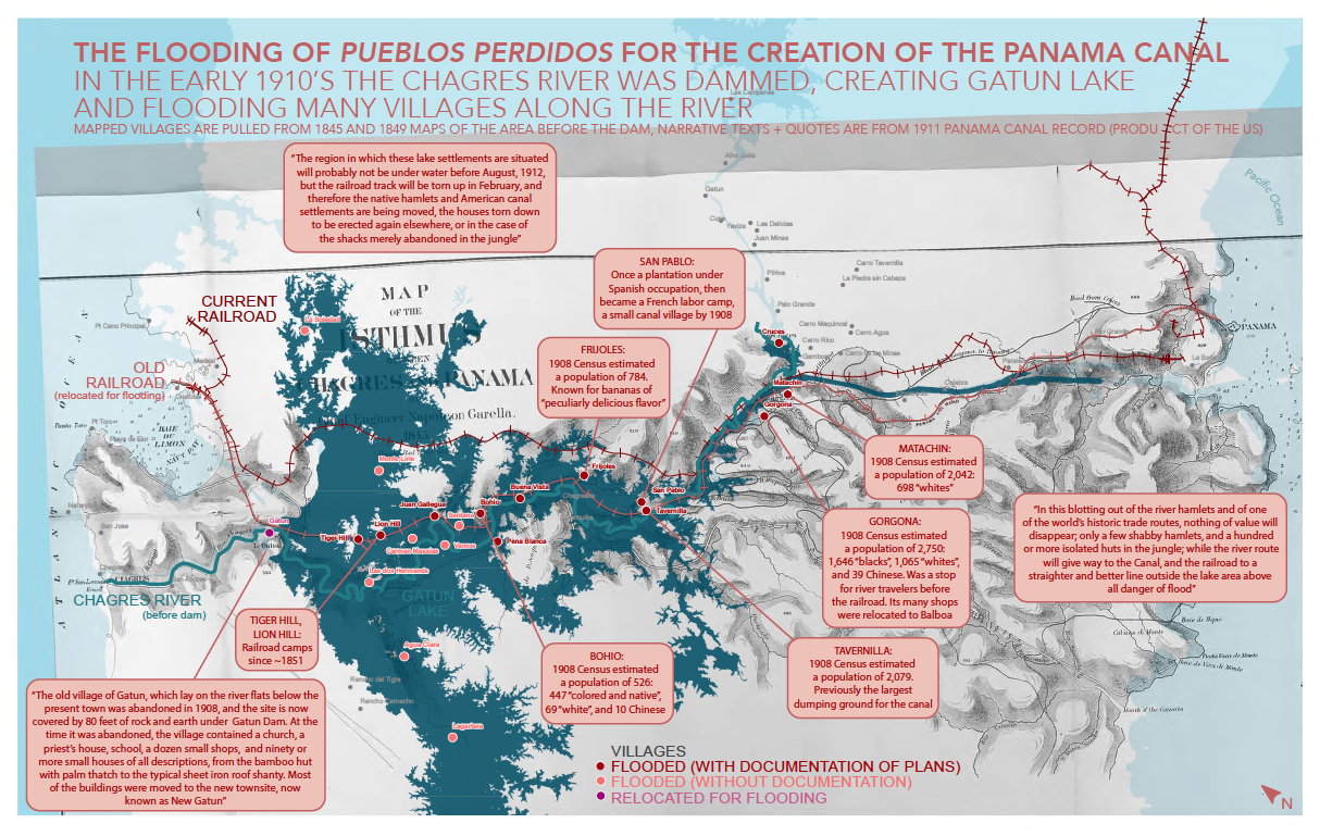
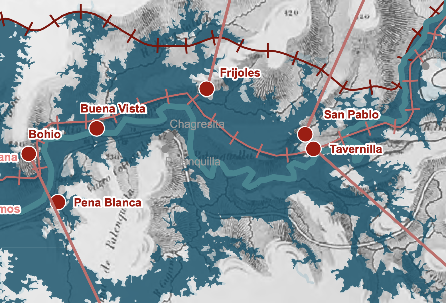
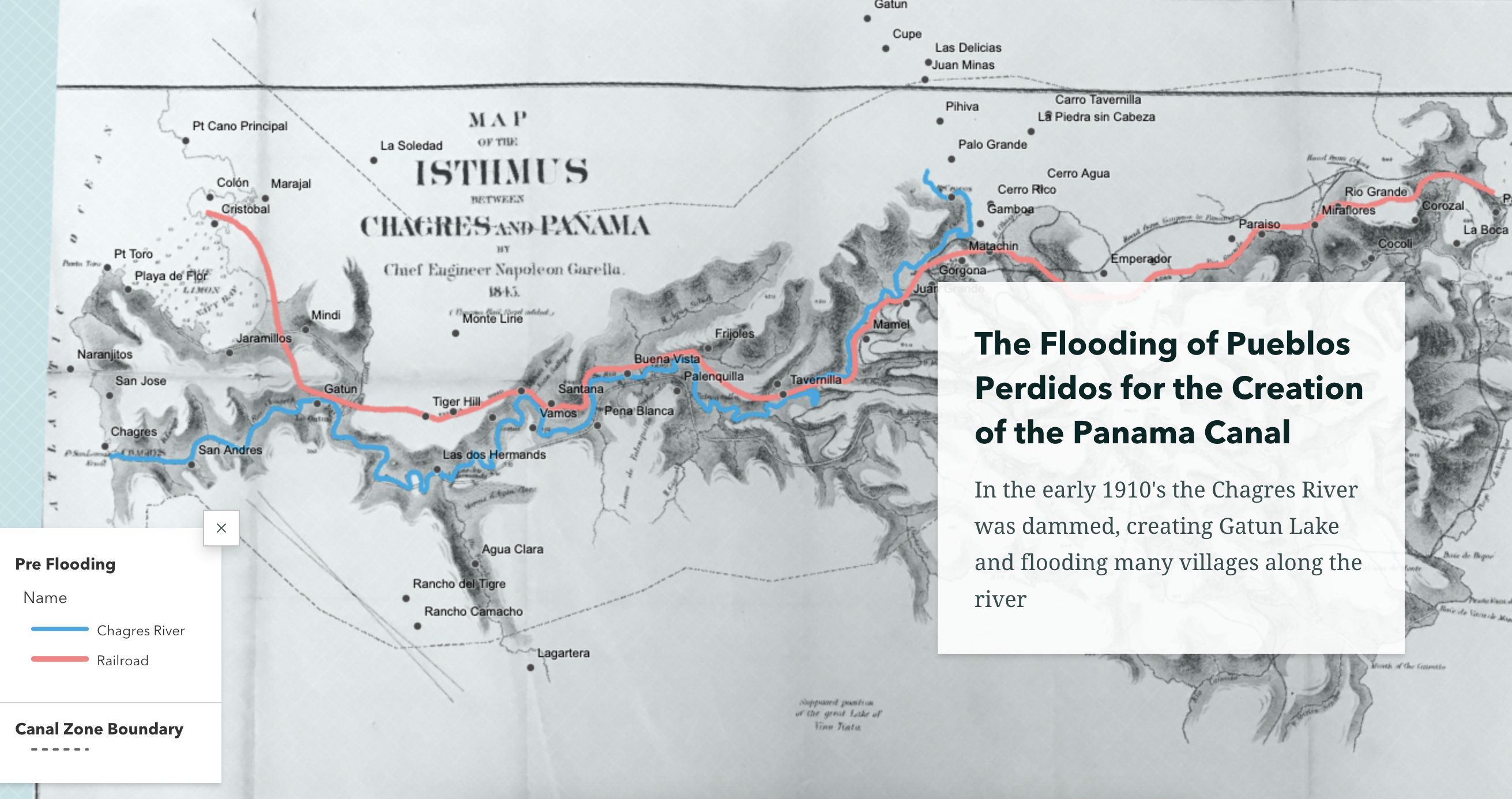
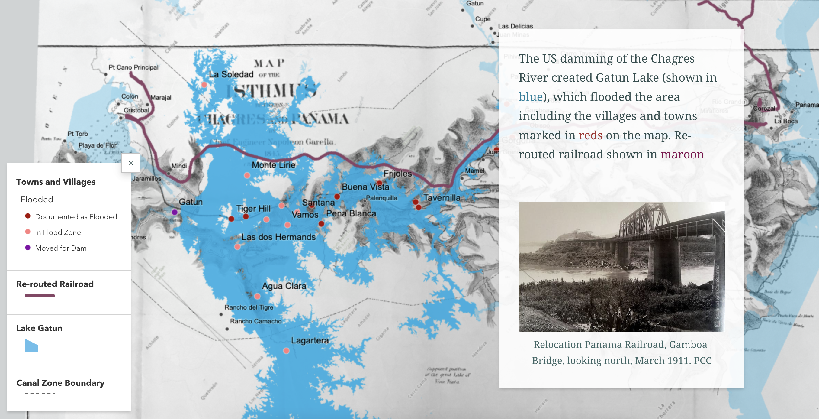
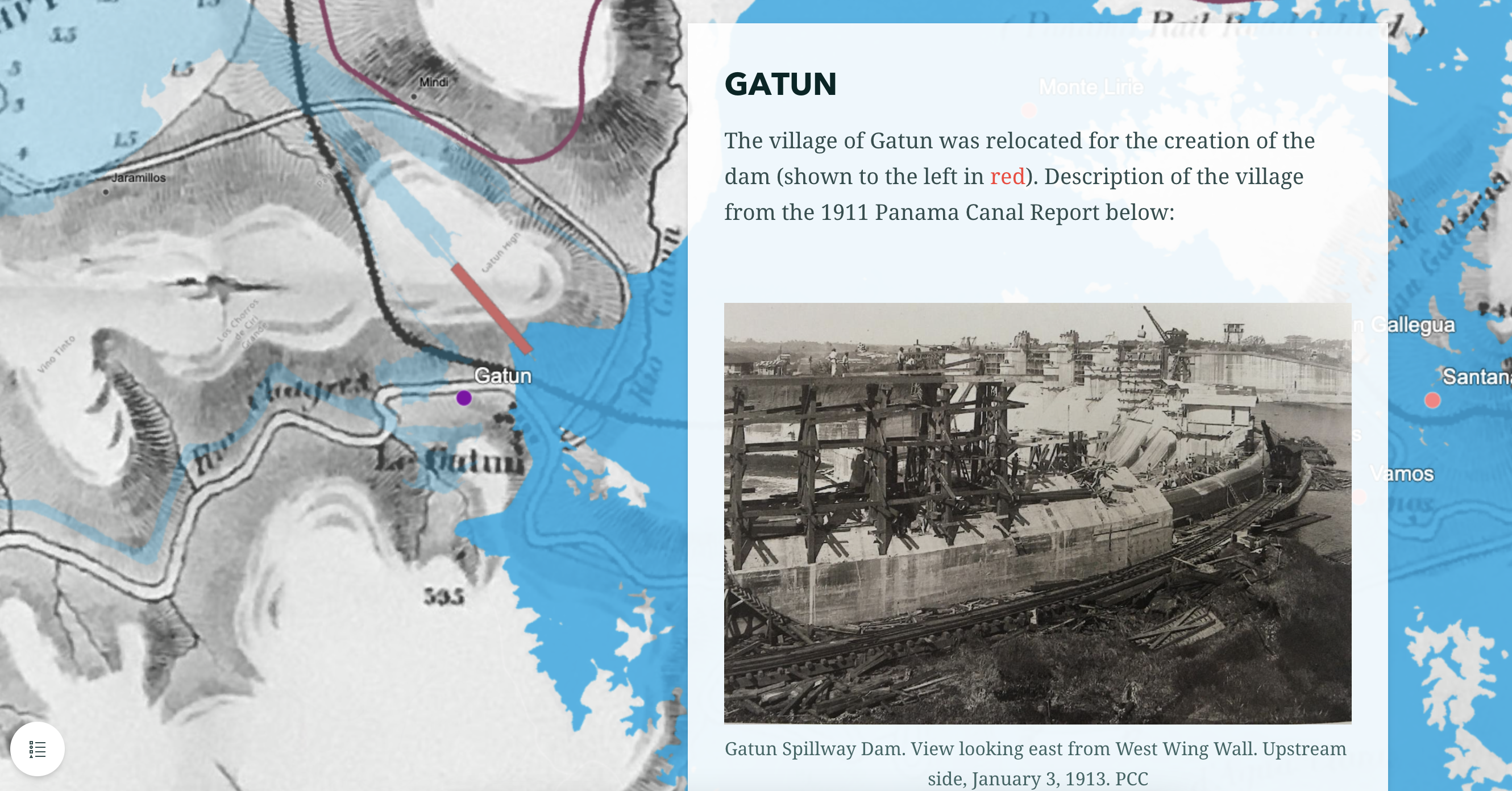
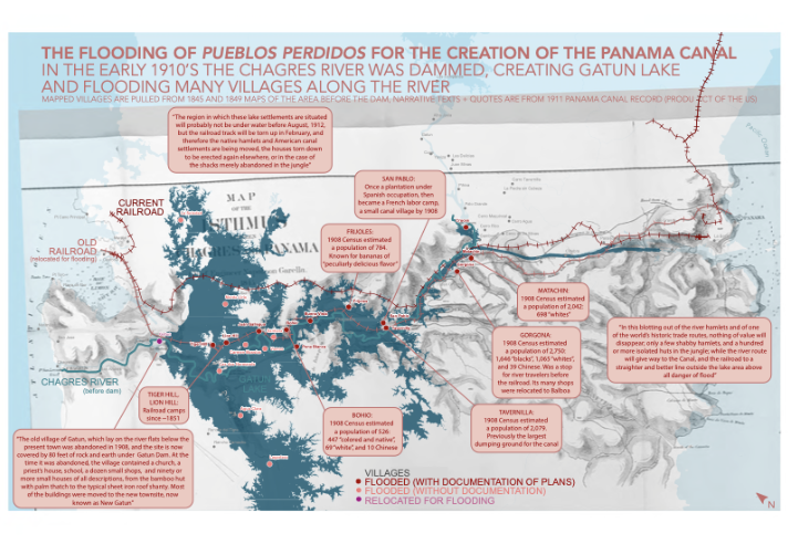
Pueblos Perdidos: The Creation of Lake Gatun
The third map explores the destruction of small migrant worker towns when the US government damned the Chagres River to create Lake Gatun and enable the creation of the Panama Canal.
Here I found a 1845 and 1849 in Berkeley's Bancroft archives and photographed them, then georeferenced them to the modern landscape showing modern Lake Gatun (in blue) and the former and current railroad lines (in red). From the 1845 and 1849 maps I pulled the names and locations of the Pueblos Perdidos (lost villages) where migrant workers lived to work on the French construction of the Panama railroad. I then contextualized these villages with text from the US's 1911 report that surveyed and reported on whether a village could be flooded or was too value to the US enterprise to destroy in the flooding.
The narrative interactive map (described further down) includes images of the towns from this report.
Interactive Map of all Three
Finally, the interactive map combines the narratives of each of these and contexutalizes them alongside a historical analysis of the time and the meaning of these little known lost stories.
Images from the section on my family's time in the Atlantic side of the Canal Zone (1952-1962):
Images from the section on my family's time in the Pacific side of the Canal Zone (1972-1982):
Images from the section on the flooding of Pueblos Perdidos:
Pulling from the conclusion: "The sacrifices made to the US occupation of Panama are countless and include land, alternative futures, and individual and community indignities. These are pieces of the counter narrative that lay in the shadows of US creation of the Panama Canal and its creation of a suburban US experience in the Canal Zone."
Purpose: Graduate school class: Global Urban Inequalities (with Professor Sai Balakrishnan)
Tools: GIS, AcrGIS Online, InDesign
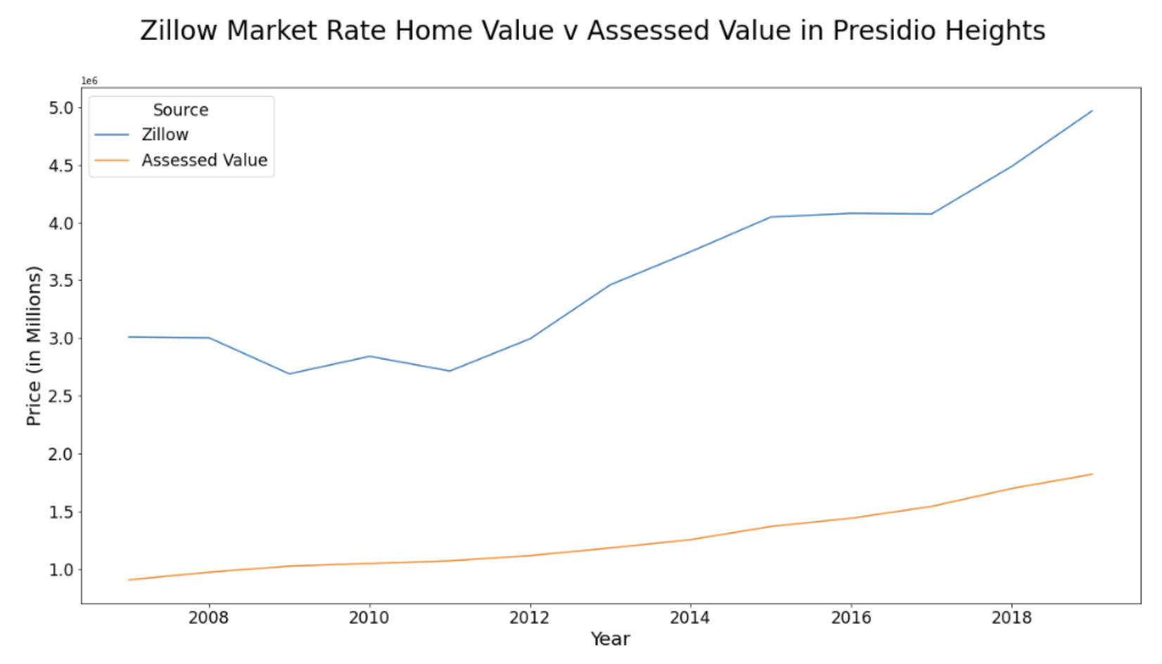
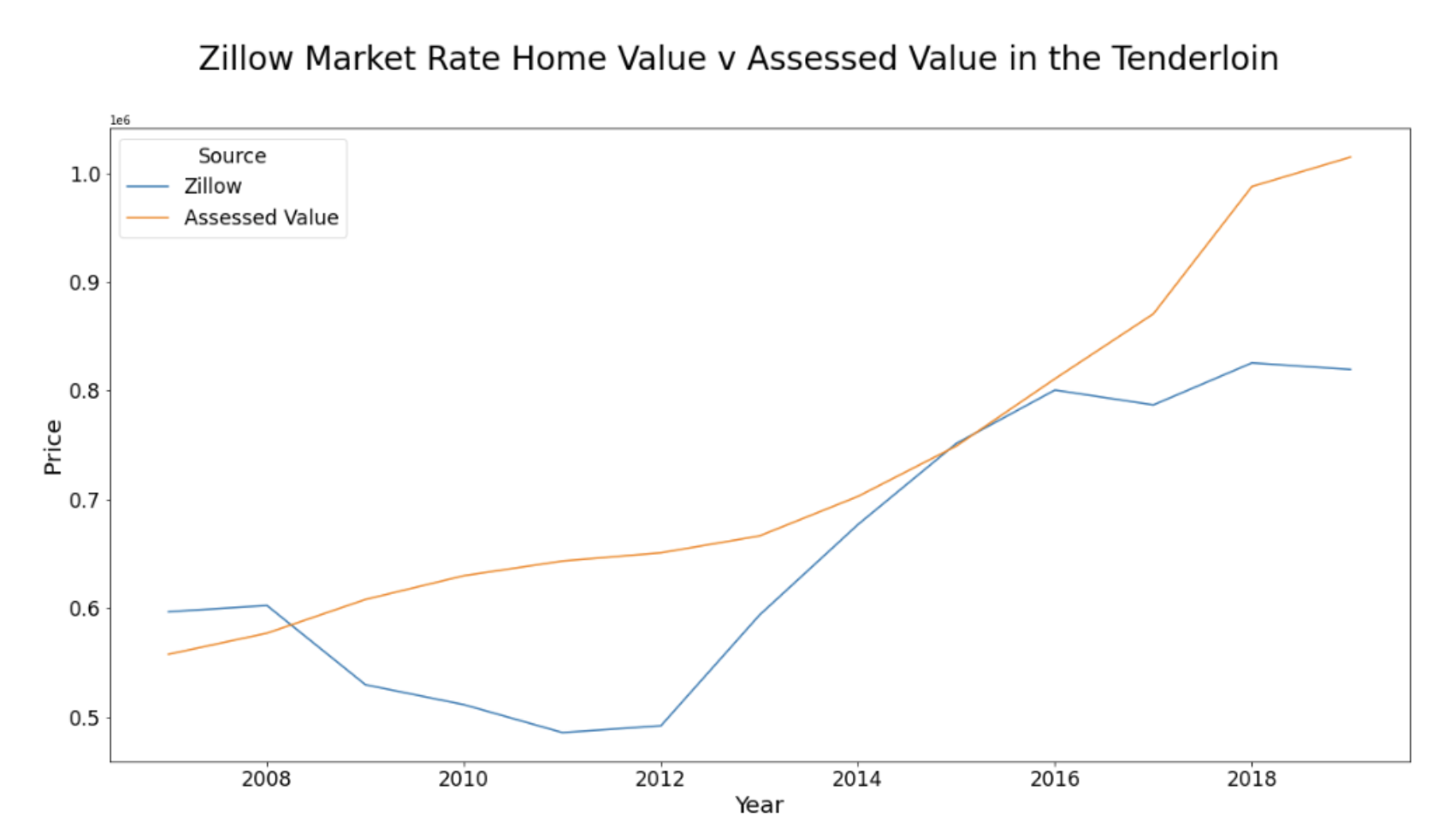
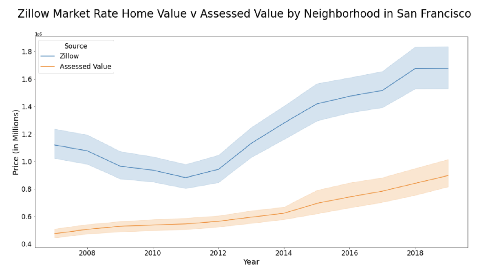
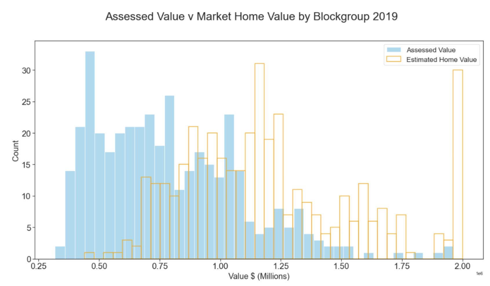
California Proposition 13: Property Tax Subsidy Analysis
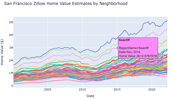
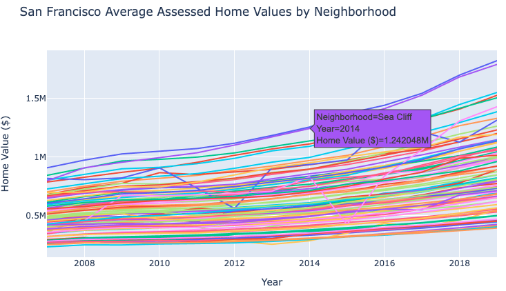
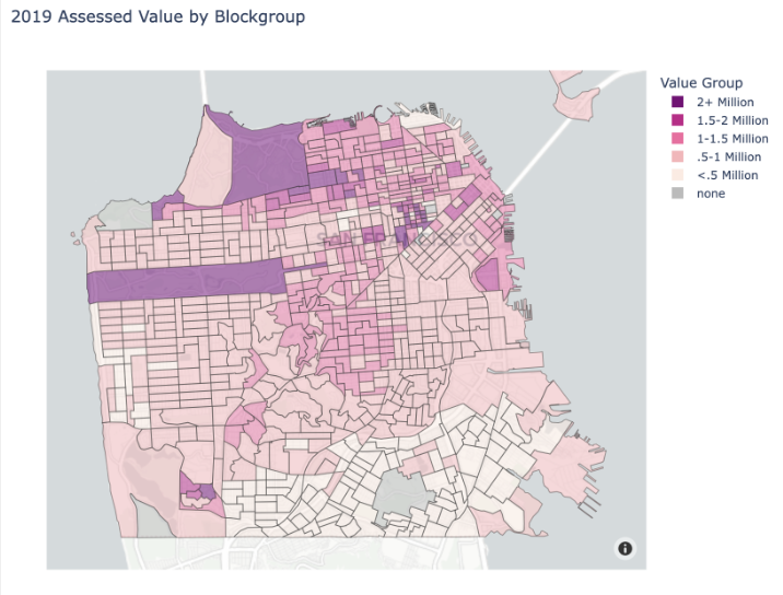
This project analyzes the impact on San Francisco's housing market of California's Proposition 13, a 1978 law that freezes property tax increase to 2% to protect homeowners from the impacts of rapidly increasing home values on their property taxes.
Using python the project explores assessed value (County of SF) and market value (zillow) by neighborhood to identify how much of a tax subsidy prop 13 provides home owners and how disproportionately this is distributed across the city.
The project looks at individual neighborhoods to compare the subsidy as it tends to provide more benefit to wealthy neighborhoods and less to neighborhoods with high rates of poverty.
Check out the project to see the complete set of visuals and interact with them. There are regressions!
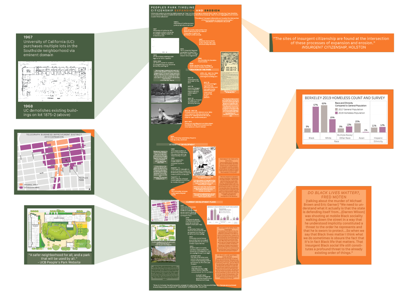
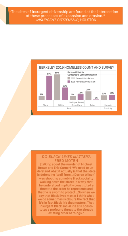
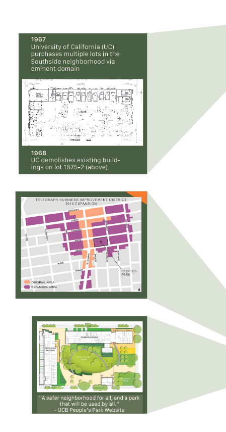
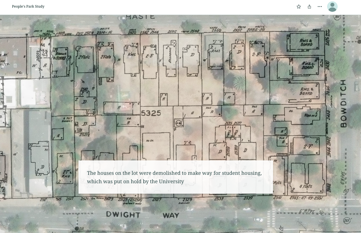
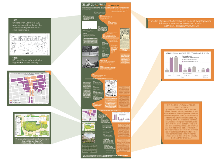
This project explores the history of Peoples Park as a contested "commons" to contextualize the current redevelopment plans by the University of California.
I informed this work by interviewing people involved in the redevelopment plans for the Park, including university planners, university social workers, and landscape architects.
The history timeline is aligned with James Holston's theory of insurgent citizenship, seeing the park occupants as claiming rights from the
university and studying how this push and pull has played out over the decades.
I also assembled three case studies of planning projects that collaborated with local unhoused occupants of public
space to assure that the future design would accommodate their needs as the heaviest users of the space. The takeaways from those are compiled in this storymap.
Purpose: Graduate school class: Planning Histories
Tool: GIS, InDesign, Storymaps
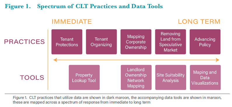
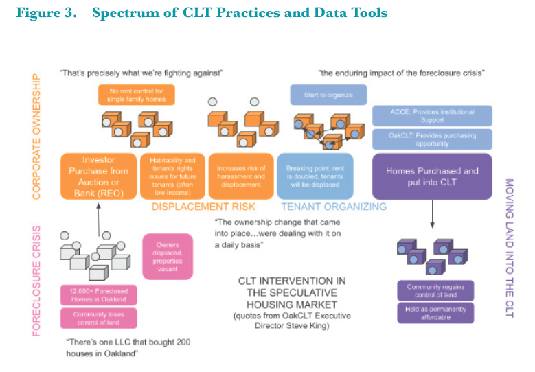
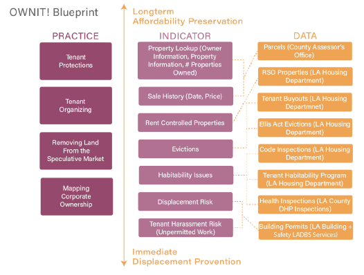
Data Driven Practices for the Decommodification of Land
My graduate school capstone project shares my findings from working with a local Community Land Trust (CLT) to use data to advance their work and from
interviews with 20+ other practitioners utilizing data for housing justice work.
Executive Summary: As community land trusts (CLTs) respond to California’s housing affordability crisis they are
utilizing data to help extend their limited capacity and funding. However, CLT-related data work is not being systematically shared, coordinated, or
leveraged to enhance the efficiency of data distribution and analysis.
To build and share this knowledge base I conducted interviews with
practitioners from CLTs and related organizations across the state to understand what questions they are answering with data and how.
Interviews
revealed that CLTs are using data in five main practices: 1) tenant protections, 2) tenant organizing, 3) removing land from the speculative market, 4)
mapping corporate ownership, and 5) advancing policy. In each of these practices, data is leveraged in conversation with community knowledge and the
interpretation of data is directed by lived experience.
Alongside stories from the field, this report includes a deep dive into the data sources
practitioners employed. Such information is useful for those working in the housing rights ecosystem to share how to answer housing questions with data and where to begin in this process.
The report features visuals that diagram key findings, maps from the projects reported on, blueprints of how projects were designed, and visuals describing how CLTs work.
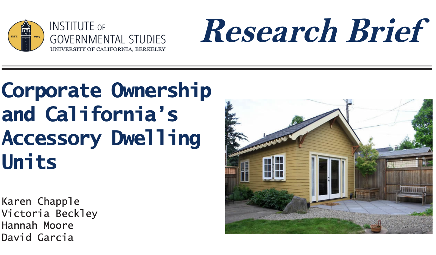
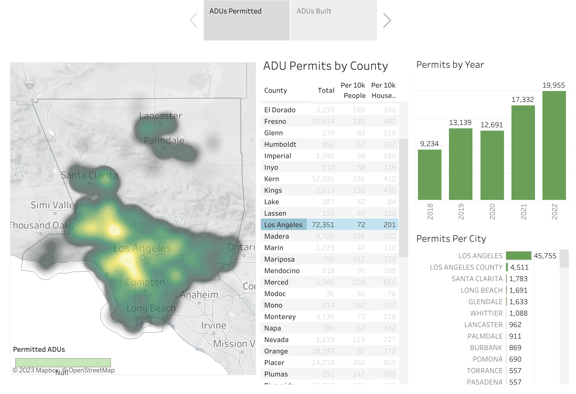
I conducted data analysis for the Center for Community Innovation to study accessory dwelling units (ADUs) production across the state and identify any city programs that have successfully promoted the development of affordable ADUs.
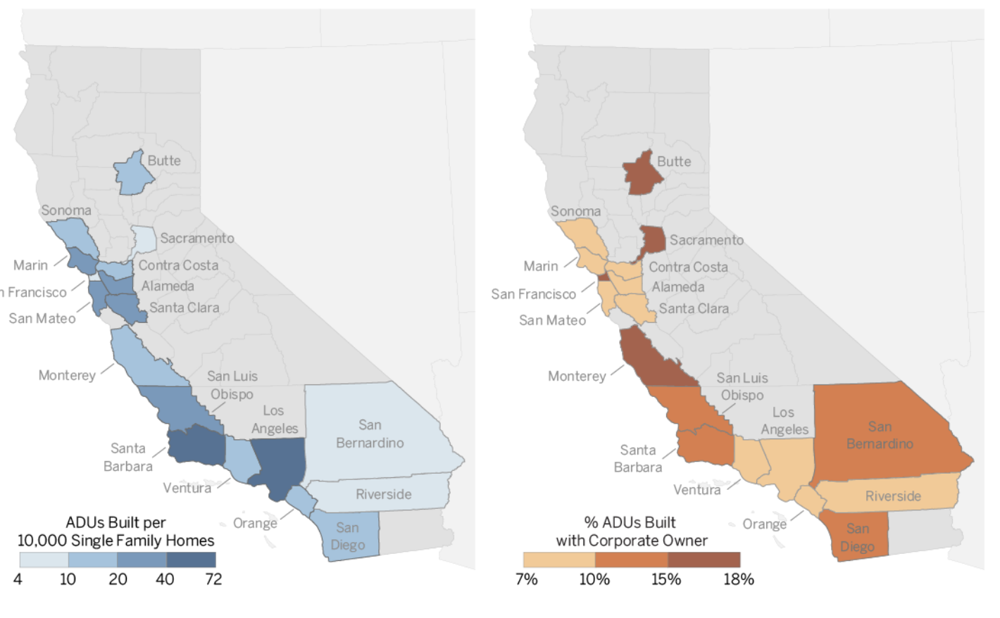
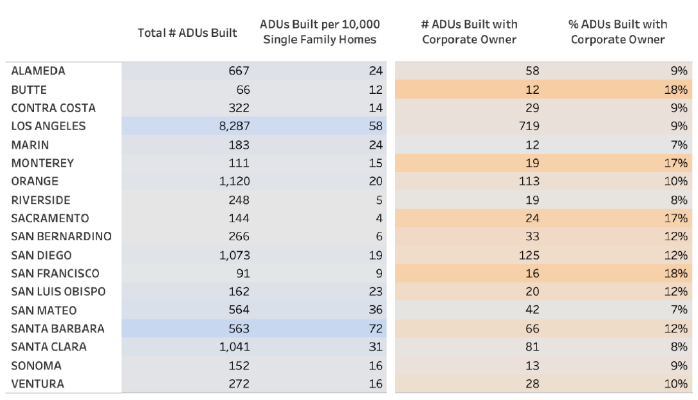
We produced this research brief, which looks at ADU production across the state in 2020 and 2021, identifying counties with disproportionately high and low production per the number of single family homes. Above is a preview of the brief, below are charts pulled from it, all link to the document.
The brief connects ADU permitting and construction to ownership data to identify the share of ADUs being produced by corporate owners across the state and finds that the percent of ADUs built on properties with a corporate owner is similar to the percent of single family homes with a corporate owner across the state, however these results vary by county.
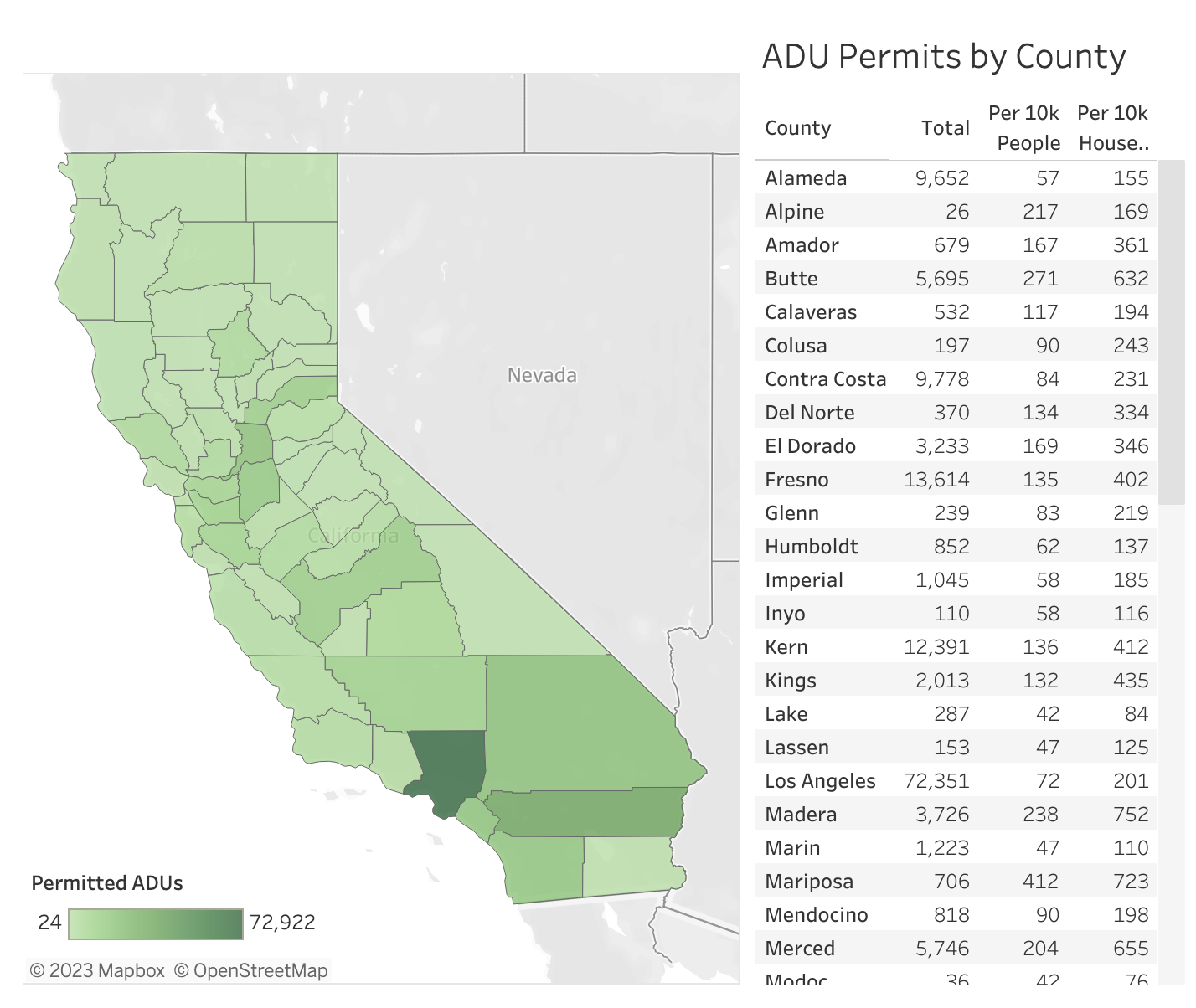
For this research I also mapped ADU permitting and construction by county and city to create a tool for users to dig into the State's most recent Annual Progress Report Data (shown and linked above and below).
The project is an on going, multi-year investigation into ADU production in the state, see the website for more details.
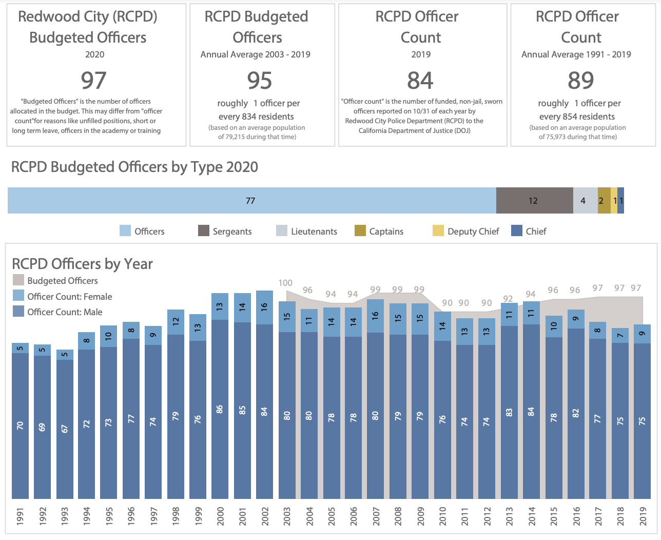
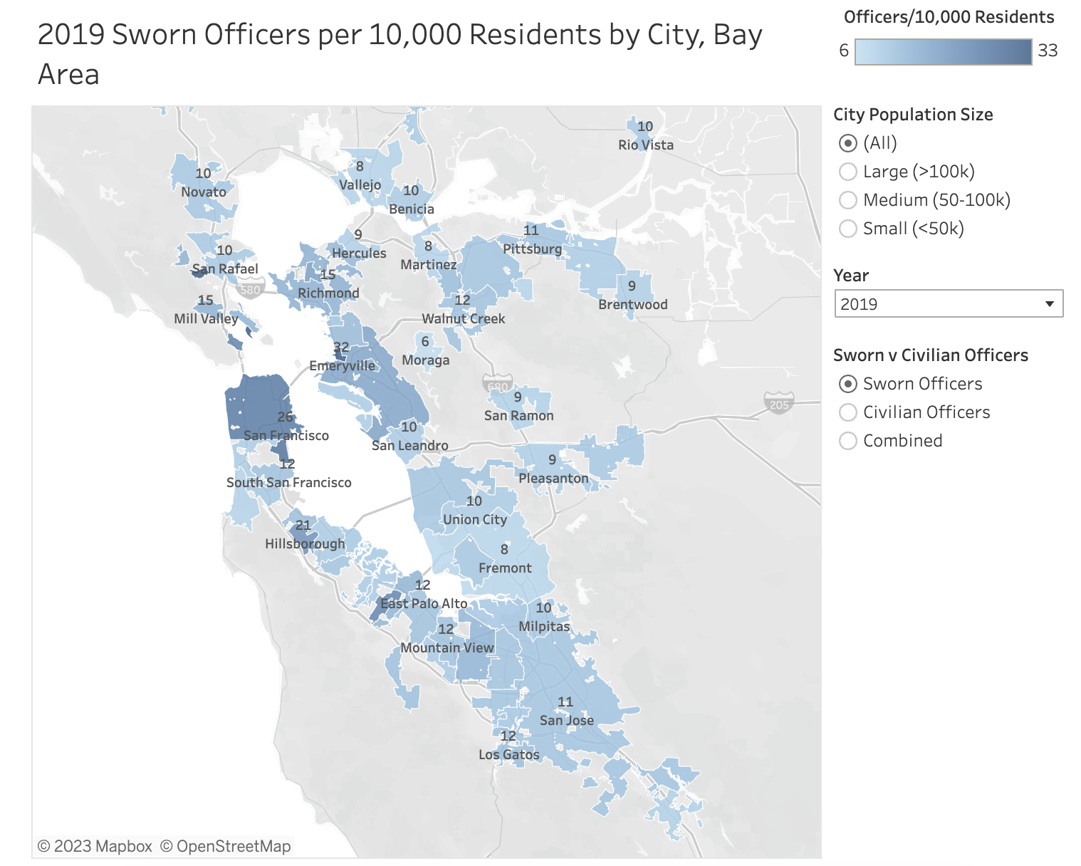
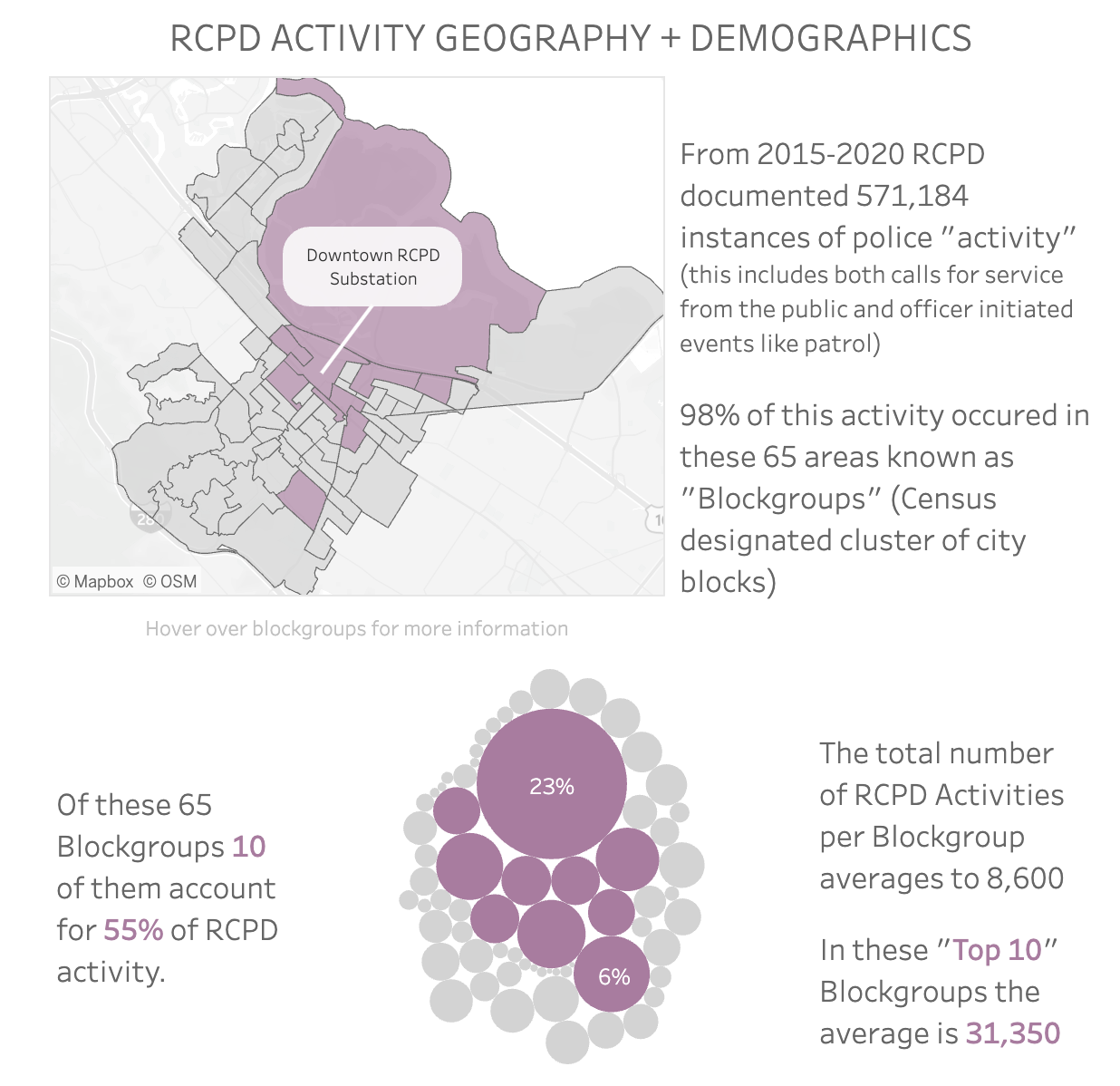
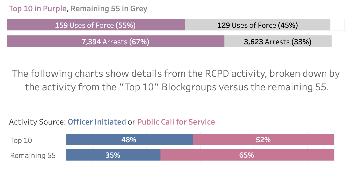
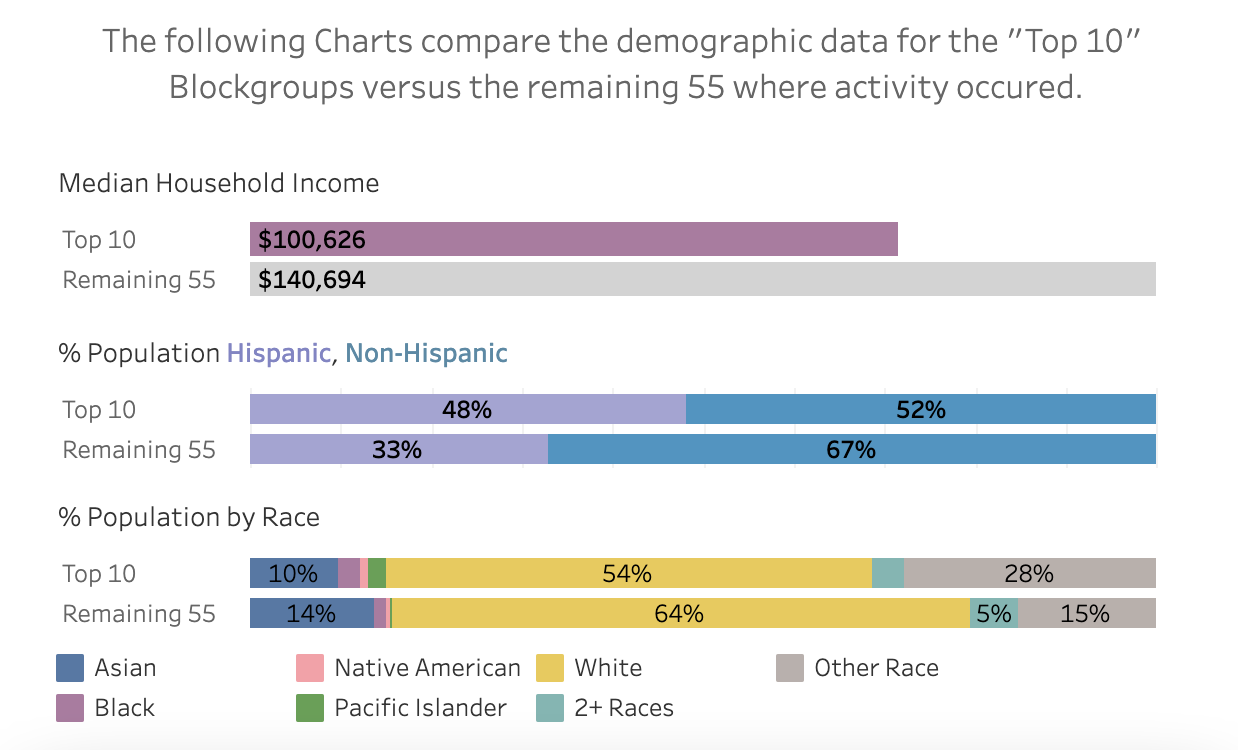
In my final two years of working in Redwood City I conducted the data analysis elements of the City Manager's Office's audit of the city' police department's data to see if it revealed any information about the department that the city should respond to.
Please note, I recognize that policing in the US is rooted in racialized surveillance and control in order uphold white supremacy and protect private property.
This analysis included Redwood City Police Department (RCPD) staffing trends overtime (above with link to document), including the gender and race of employed officers and promotions given from 2006-2021.
The research looked at trends across the state of number of employed officers by city per capita (above with link to project).
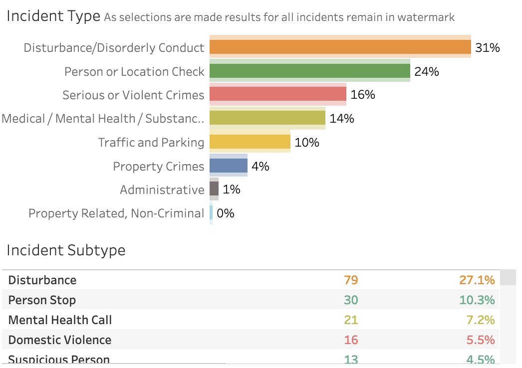
It also included a dive into documented police activity via the department's RIMS (Record and Case Management System),
pulling in neighborhood demographics to consider in context of policy activity levels (above with link to project).
Finally, it looked at police use of force (as it is required to be reported to the state) and the recorded race, gender, age, any documented injury, and the type of force used (please be warned of disturbing content)(shown and linked above).
The project failed to produce actionable outcomes as quantitative data needs qualitative data to contextualize and historicize the information. As such, it was not possible to prove over policing or discriminatory behavior from the information available.
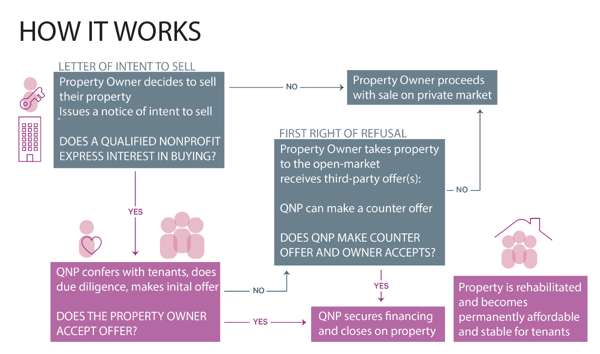
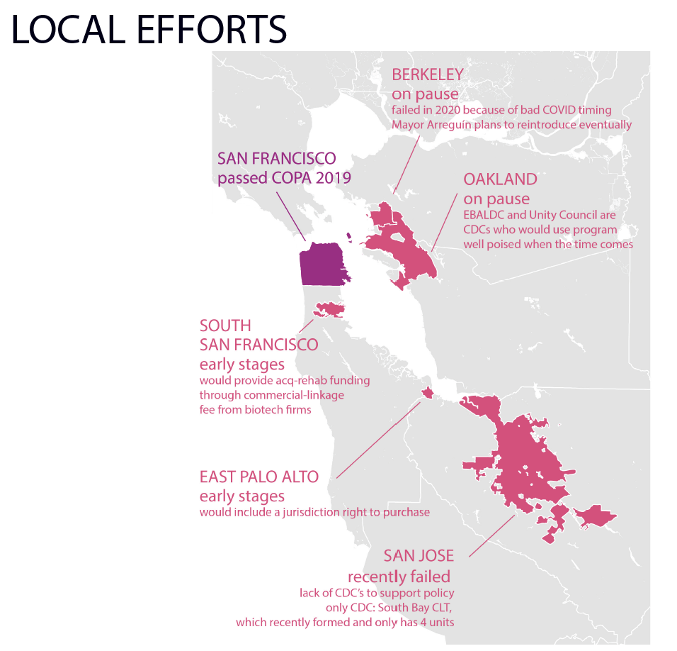
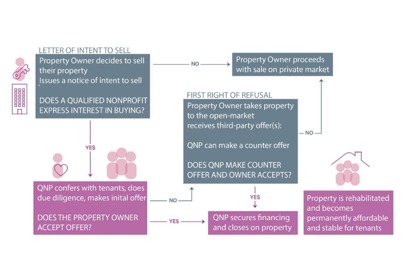
I explored local policies for opportunity to purchase acts, commonly called TOPA or COPA. TOPA offers an opportunity for tenants to purchase a building before it goes to the private market, and COPA works similarly giving first right to purchase to community non-profits.
The brief connects ADU permitting and construction to ownership data to identify the share of ADUs being produced by corporate owners across the state and finds that the percent of ADUs built on properties with a corporate owner is similar to the percent of single family homes with a corporate owner across the state, however these results vary by county.
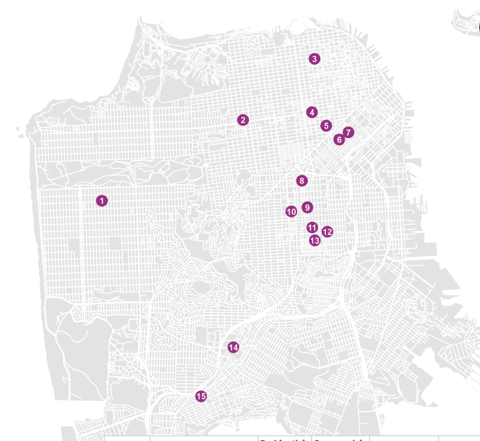
The above map shows the locations of San Francisco's COPA enabled acquisitions.
The policy has successfully allowed community orgs to work with tenants to acquire properties when they go for sale, and the policy has not had a detrimental effect on the local housing market, as opposition to these policies typically fear.
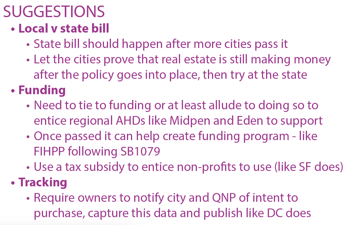
Finally, I compiled some suggestions pulled from my interviews about how to lead a more successful campaign.
Date: 2023
Purpose: Graduate school class: Community Development (with Professor Carolina Reid)
Tools: GIS, Tableau, InDesign, Illustrator
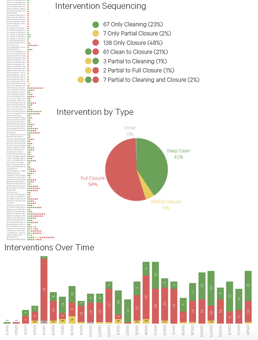
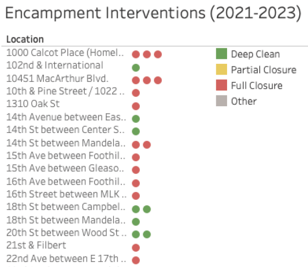
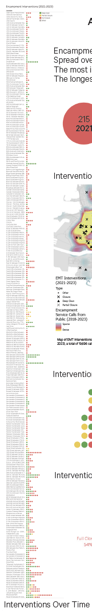
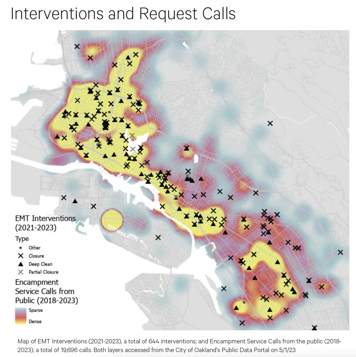
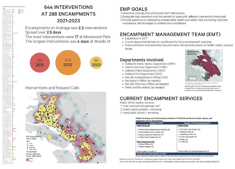
Oakland's Encampment Management Plan Study
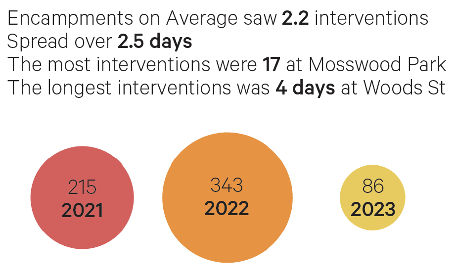
I reviewed existing data and reports about Oakland's controversial Encampment Management Plan, adopted in October 2020 as a response to the crisis of people living unhoused in Oakland.
I specifically looked at how Oakland services or evicts encampments, including the intentions pulled from the original plan and public data of where they carry out encampment "interventions".
The interventions are classified as deep cleans, partial cleans, or full closures. I wanted to track the sequencing of these across encampments to see if there were attempts to help those living in an encampment reach a clean and safe living condition before the city resorted to evicting people and demolishing the camp.
My report shows all interventions across the various encampments from 2021-2023 (above).
The above map looks at calls for service that reference unhoused people in relation to encampment "interventions".
Finally, the findings call for a reorientation of services towards providing for people's basic needs like showers, laundry services, and bathrooms to help stabilize the lives of people living in the camps and promote cleaner and safer environments for the occupants and for housed neighbors.
Date: 2023
Purpose: Graduate school class: Homelessness in California


 Data analysis and mapping supports the effort of Richmond LAND staff and their community collaborators to answer housing questions, promote their policy campaigns, and help identify sites for ac-rehab.
 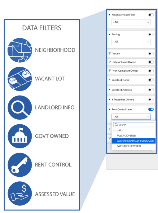 We created a site suitability tool to help staff identify properties that might be suitable to acquire and rehabilitate into the land trust. This tool includes abilities to filter properties using vacancy status, ownership type (city or private), assessed value, number of properties owned, owner location (Richmond, outside Richmond, different state), and owner non-compliance (might signal negligent landlord).
 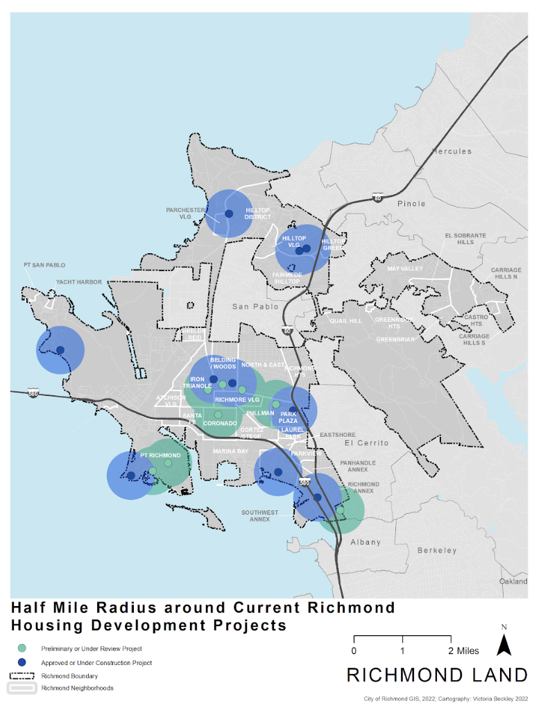 This work also includes producing visuals for various research and campaigns. Including in depth property lookups for sites being considered for acquisition and maps of properties within a half mile of current "pipeline" housing developments underway (shown above).
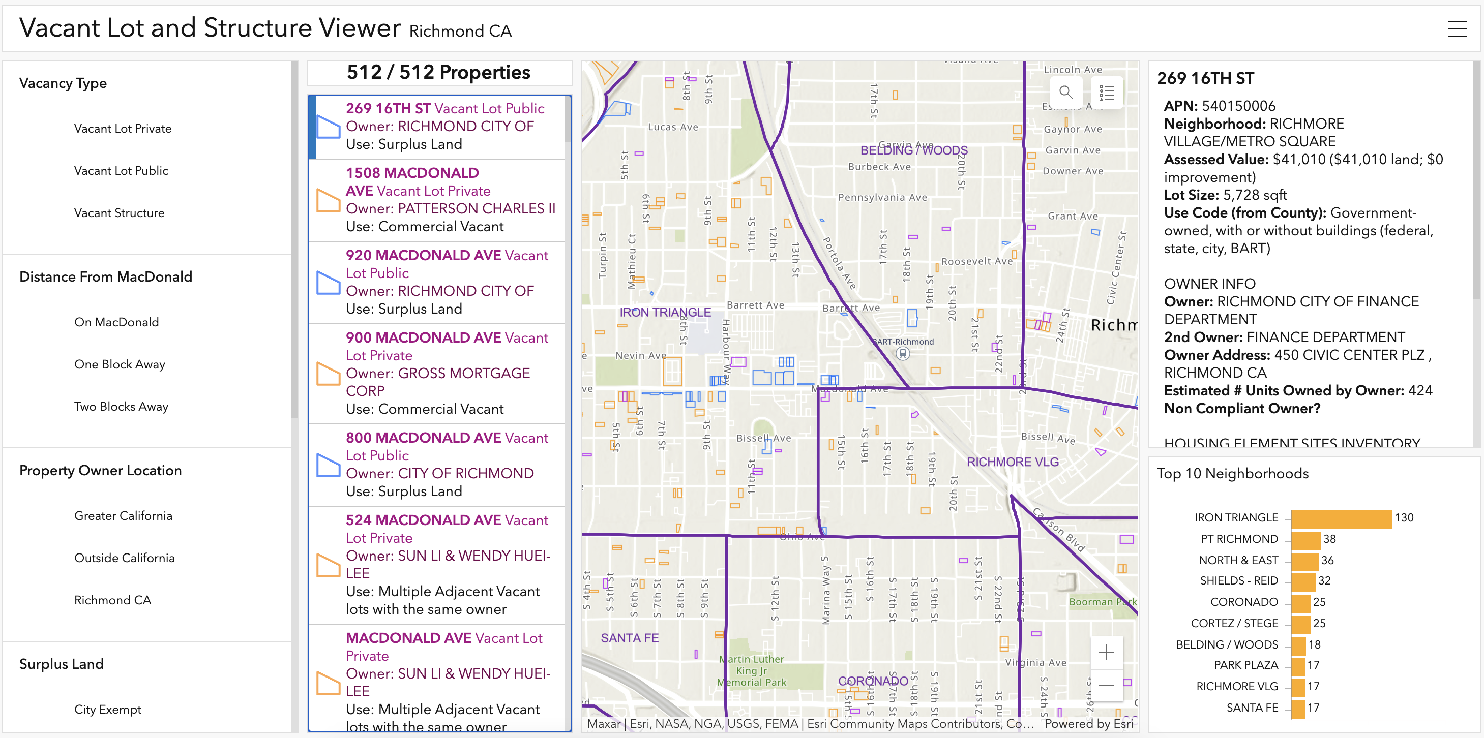
 Additionally, we've produced interactive visual tools for exploring tax delinquent properties, vacant sites, and city owned properties in Richmond to assess low-cost acquisition feasibility. Screenshots from the vacancy viewer are shown above.